Caxias do Sul geodata
Caxias do Sul (Rio Grande do Sul) is a populated place; located in Brazil in America/Sao_Paulo (GMT-3) time zone. With population of 381,270 people, there are 52 cities with bigger population in this country. Compared to other cities in Brazil, 96.1% of cities are located further ↑North; 83.8% of cities are located further →East and 88.2% of cities have lower elevation than Caxias do Sul. Note1


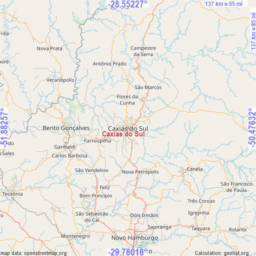
Caxias do Sul GPS coordinates[2]
29° 10' 5.016" South, 51° 10' 45.984" West
| Map corner | latitude | longitude |
|---|---|---|
| Upper-left | -28.55227°, | -51.88257° |
| Center: | -29.16806°, | -51.17944° |
| Lower-right: | -29.78018°, | -50.47632° |
| Map W x H: | 136.5×136.5 km | = 84.8×84.8mi |
| max Lat: | 2.81972° ⇑96.1% North |
| Caxias do Sul: | -29.16806° |
| min Lat: | ⇓3.9% South -33.69111° |
| min Long | Caxias do Sul | max Long |
| -72.89583° | -51.17944° | -32.41083° |
| W 16.2%⇐ | ⇒83.8% E |
Elevation
Elevation of Caxias do Sul is 787 m = 2582 ft, and this is 406.1 m = 1332 ft above average elevation for this country.
| Max E: |
1603 m = 5259 ft | 11.8% |
| Caxias do Sul | 787 m 2582 ft | |
| Avg. | 380.9 m = 1250 ft | |
Min E: |
0 m = 0 ft | 88.2% |
See also: Caxias do Sul elevation on elevation.city.
Geographical zone
Caxias do Sul is located in South temperate zone (between Tropic of Capricorn and the Antarctic Circle). Distance of this Southern Tropic circle is 637.3 km =396 mi to North.| Distance of | km | miles | from Caxias do Sul |
|---|---|---|---|
| Equator | 3243.2 | 2015.2 | to North |
| Tropic Capricorn | 637.3 | 396 | to North |
| Antarctic Circle | 4158 | 2583.7 | to South |
| South Pole | 6763.9 | 4202.9 | to South |


Nearby cities:
15 places around Caxias do Sul: (largest is in red/bold)
• Bento Gonçalves
33 km =20.5 mi,  269°
269°
• Canela
41.2 km =25.6 mi,  120°
120°
• Carlos Barbosa
34.6 km =21.5 mi,  245°
245°
• Estância Velha
53.4 km =33.2 mi,  179°
179°
• Farroupilha
17.5 km =10.9 mi, 248°
• Flores da Cunha
15.5 km =9.6 mi,  359°
359°
• Garibaldi
35.7 km =22.2 mi, 254°
• Ivoti
47.1 km =29.3 mi, 177°
• Nova Petrópolis
24 km =14.9 mi,  164°
164°
• Novo Hamburgo
56.9 km =35.4 mi, 175°
• Sapiranga
54.9 km =34.1 mi, 162°
• São Marcos
24.4 km =15.2 mi,  26°
26°
• São Sebastião do Caí
50.3 km =31.3 mi,  202°
202°
• Três Coroas
55 km =34.2 mi,  134°
134°
• Veranópolis
44.3 km =27.5 mi,  305°
305°
Sources, notices
• [Note1] Compared only with cities in Brazil existing in our database
• [Src1] Map data: © OpenStreetMap contributors (CC-BY-SA)
• [Src2] Other city data from geonames.org with taken over terms of usage.
• [Src3] Geographical zone / Annual Mean Temperature by Robert A. Rohde @ Wikipedia
