Andrelândia geodata
Andrelândia (Minas Gerais) is a populated place; located in Brazil in America/Sao_Paulo (GMT-3) time zone. With population of 10,079 people, there are 1642 cities with bigger population in this country. Compared to other cities in Brazil, 68.3% of cities are located further ↑North; 54.2% of cities are located further ←West and 97.6% of cities have lower elevation than Andrelândia. Note1


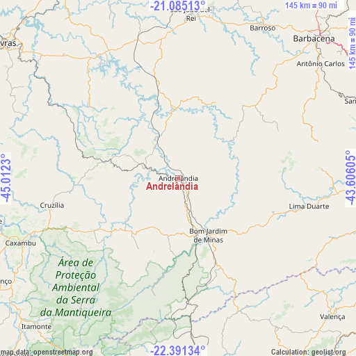
Andrelândia GPS coordinates[2]
21° 44' 22.992" South, 44° 18' 33.012" West
| Map corner | latitude | longitude |
|---|---|---|
| Upper-left | -21.08513°, | -45.0123° |
| Center: | -21.73972°, | -44.30917° |
| Lower-right: | -22.39134°, | -43.60605° |
| Map W x H: | 145.2×145.2 km | = 90.2×90.2mi |
| max Lat: | 2.81972° ⇑68.3% North |
| Andrelândia: | -21.73972° |
| min Lat: | ⇓31.7% South -33.69111° |
| min Long | Andrelândia | max Long |
| -72.89583° | -44.30917° | -32.41083° |
| W 54.2%⇐ | ⇒45.8% E |
Elevation
Elevation of Andrelândia is 964 m = 3163 ft, and this is 583.1 m = 1913 ft above average elevation for this country.
| Max E: |
1603 m = 5259 ft | 2.4% |
| Andrelândia | 964 m 3163 ft | |
| Avg. | 380.9 m = 1250 ft | |
Min E: |
0 m = 0 ft | 97.6% |
See also: Brazil elevation on elevation.city.
Geographical zone
Andrelândia is located in South Torrid zone (between Equator and Tropic of Capricorn). Distance of this Southern Tropic circle is 188.7 km =117.3 mi to South.| Distance of | km | miles | from Andrelândia |
|---|---|---|---|
| Equator | 2417.2 | 1502 | to North |
| Tropic Capricorn | 188.7 | 117.3 | to South |
| Antarctic Circle | 4983.9 | 3096.9 | to South |
| South Pole | 7589.8 | 4716.1 | to South |


Nearby cities:
15 places around Andrelândia: (largest is in red/bold)
• Baependi
64.7 km =40.2 mi,  247°
247°
• Barbacena
79.6 km =49.5 mi,  44°
44°
• Barroso
70.5 km =43.8 mi,  29°
29°
• Caxambu
69.5 km =43.2 mi, 247°
• Conceição do Rio Verde
81.6 km =50.7 mi,  258°
258°
• Cruzília
52.7 km =32.7 mi, 257°
• Lima Duarte
54.5 km =33.9 mi,  102°
102°
• Porto Real
75.6 km =47 mi,  178°
178°
• Quatis
74.4 km =46.2 mi, 175°
• Resende
82.3 km =51.1 mi,  189°
189°
• Santos Dumont
84.3 km =52.4 mi,  68°
68°
• São João del Rei
67.4 km =41.9 mi,  4°
4°
• São Lourenço
87.5 km =54.4 mi,  241°
241°
• Tiradentes
71.3 km =44.3 mi,  10°
10°
• Valença
84.3 km =52.4 mi,  131°
131°
Sources, notices
• [Note1] Compared only with cities in Brazil existing in our database
• [Src1] Map data: © OpenStreetMap contributors (CC-BY-SA)
• [Src2] Other city data from geonames.org with taken over terms of usage.
• [Src3] Geographical zone / Annual Mean Temperature by Robert A. Rohde @ Wikipedia
