Dunmore Town geodata
Dunmore Town (Harbour Island) is a populated place; located in Bahamas in America/Nassau (GMT-4) time zone. With population of 1,523 people, there are 11 cities with bigger population in this country. Compared to other cities in Bahamas, 62.5% of cities are located further ↓South; 50% of cities are located further ←West and 91.7% of cities have lower elevation than Dunmore Town. Note1


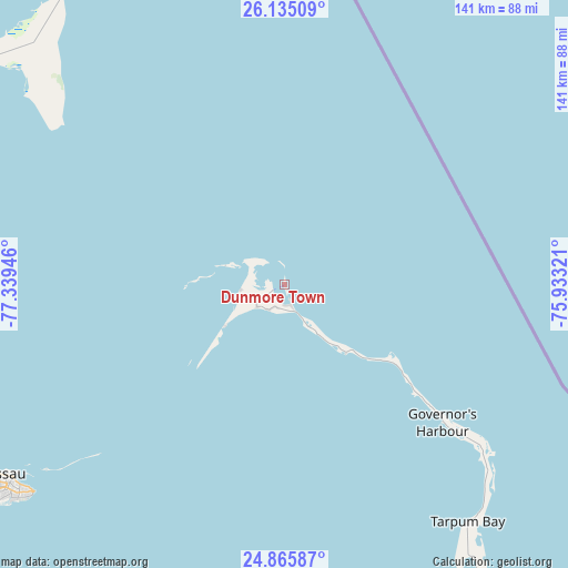
Dunmore Town GPS coordinates[2]
25° 30' 7.776" North, 76° 38' 10.788" West
| Map corner | latitude | longitude |
|---|---|---|
| Upper-left | 26.13509°, | -77.33946° |
| Center: | 25.50216°, | -76.63633° |
| Lower-right: | 24.86587°, | -75.93321° |
| Map W x H: | 141.1×141.1 km | = 87.7×87.7mi |
| max Lat: | 26.87137° ⇑37.5% North |
| Dunmore Town: | 25.50216° |
| min Lat: | ⇓62.5% South 20.94982° |
| min Long | Dunmore Town | max Long |
| -79.29721° | -76.63633° | -72.96667° |
| W 50%⇐ | ⇒50% E |
Elevation
Elevation of Dunmore Town is 18 m = 59 ft, and this is 8.5 m = 28 ft above average elevation for this country.
| Max E: |
27 m = 89 ft | 8.3% |
| Dunmore Town | 18 m 59 ft | |
| Avg. | 9.5 m = 31 ft | |
Min E: |
1 m = 3 ft | 91.7% |
See also: Bahamas elevation on elevation.city.
Geographical zone
Dunmore Town is located in North temperate zone (between Tropic of Cancer and the Arctic Circle). Distance of this Northern Tropic circle is 229.7 km =142.7 mi to South.| Distance of | km | miles | from Dunmore Town |
|---|---|---|---|
| North Pole | 7171.5 | 4456.2 | to North |
| Arctic Circle | 4565.6 | 2836.9 | to North |
| Tropic Cancer | 229.7 | 142.7 | to South |
| Equator | 2835.6 | 1762 | to South |


Nearby cities:
15 places around Dunmore Town: (largest is in red/bold)
• Andros Town
144.4 km =89.7 mi,  232°
232°
• Arthur’s Town
137.9 km =85.7 mi,  135°
135°
• Black Point
158 km =98.2 mi,  170°
170°
• Cockburn Town
266.8 km =165.8 mi,  127°
127°
• Cooper’s Town
175.5 km =109.1 mi,  330°
330°
• Freeport
235.9 km =146.6 mi,  299°
299°
• George Town
237 km =147.3 mi,  158°
158°
• Governor’s Harbour
55.1 km =34.2 mi, 132°
• Hard Bargain
129.8 km =80.7 mi,  314°
314°
• High Rock
205.1 km =127.4 mi, 306°
• Lucaya
233 km =144.8 mi, 299°
• Marsh Harbour
123.2 km =76.6 mi,  339°
339°
• Nassau
86.5 km =53.7 mi,  235°
235°
• San Andros
150.1 km =93.3 mi,  251°
251°
• Spanish Wells
13.8 km =8.6 mi,  291°
291°
Sources, notices
• [Note1] Compared only with cities in Bahamas existing in our database
• [Src1] Map data: © OpenStreetMap contributors (CC-BY-SA)
• [Src2] Other city data from geonames.org with taken over terms of usage.
• [Src3] Geographical zone / Annual Mean Temperature by Robert A. Rohde @ Wikipedia
