Black Point geodata
Black Point is a seat of a first-order administrative division; located in Bahamas in America/Nassau (GMT-4) time zone. In our database, there are 21 cities with bigger population. Compared to other cities in Bahamas, 62.5% of cities are located further ↑North; 54.2% of cities are located further ←West and 58.3% of cities have lower elevation than Black Point. Note1


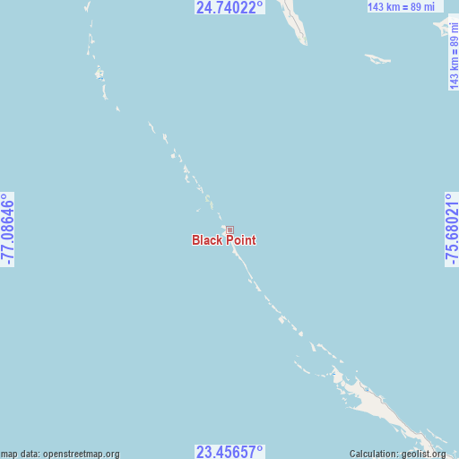
Black Point GPS coordinates[2]
24° 6' 0" North, 76° 22' 59.988" West
| Map corner | latitude | longitude |
|---|---|---|
| Upper-left | 24.74022°, | -77.08646° |
| Center: | 24.1°, | -76.38333° |
| Lower-right: | 23.45657°, | -75.68021° |
| Map W x H: | 142.7×142.7 km | = 88.7×88.7mi |
| max Lat: | 26.87137° ⇑62.5% North |
| Black Point: | 24.1° |
| min Lat: | ⇓37.5% South 20.94982° |
| min Long | Black Point | max Long |
| -79.29721° | -76.38333° | -72.96667° |
| W 54.2%⇐ | ⇒45.8% E |
Elevation
Elevation of Black Point is 9 m = 30 ft, and this is 0.5 m = 2 ft below average elevation for this country.
| Max E: |
27 m = 89 ft | 41.7% |
| Avg. | 9.5 m = 31 ft | |
| Black Point | 9 m = 30 ft | |
Min E: |
1 m = 3 ft | 58.3% |
See also: Bahamas elevation on elevation.city.
Geographical zone
Black Point is located in North temperate zone (between Tropic of Cancer and the Arctic Circle). Distance of this Northern Tropic circle is 73.7 km =45.8 mi to South.| Distance of | km | miles | from Black Point |
|---|---|---|---|
| North Pole | 7327.4 | 4553 | to North |
| Arctic Circle | 4721.5 | 2933.8 | to North |
| Tropic Cancer | 73.7 | 45.8 | to South |
| Equator | 2679.7 | 1665.1 | to South |


Nearby cities:
15 places around Black Point: (largest is in red/bold)
• Andros Town
155.6 km =96.7 mi,  295°
295°
• Arthur’s Town
92.6 km =57.5 mi,  51°
51°
• Clarence Town
180.9 km =112.4 mi,  127°
127°
• Cockburn Town
188.1 km =116.9 mi,  91°
91°
• Colonel Hill
268 km =166.5 mi,  123°
123°
• Duncan Town
222.7 km =138.4 mi,  162°
162°
• Dunmore Town
158 km =98.2 mi,  350°
350°
• George Town
88.9 km =55.2 mi,  136°
136°
• Governor’s Harbour
119.6 km =74.3 mi,  7°
7°
• Hard Bargain
273.7 km =170.1 mi,  334°
334°
• Marsh Harbour
279.9 km =173.9 mi, 345°
• Nassau
144.1 km =89.5 mi,  317°
317°
• Port Nelson
164.6 km =102.3 mi,  107°
107°
• San Andros
199.9 km =124.2 mi, 302°
• Spanish Wells
165.4 km =102.8 mi, 346°
Sources, notices
• [Note1] Compared only with cities in Bahamas existing in our database
• [Src1] Map data: © OpenStreetMap contributors (CC-BY-SA)
• [Src2] Other city data from geonames.org with taken over terms of usage.
• [Src3] Geographical zone / Annual Mean Temperature by Robert A. Rohde @ Wikipedia
