Tlhareselele geodata
Tlhareselele (Ngwaketsi) is a populated place; located in Botswana in Africa/Gaborone (GMT+2) time zone. With population of 804 people, there are 94 cities with bigger population in this country. Compared to other cities in Botswana, 96.2% of cities are located further ↑North; 61% of cities are located further →East and 98.1% of cities have lower elevation than Tlhareselele. Note1


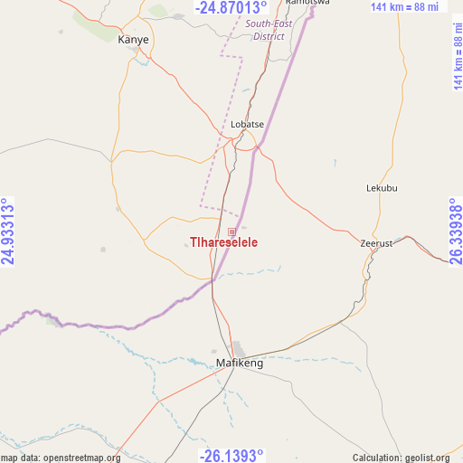
Tlhareselele GPS coordinates[2]
25° 30' 23.004" South, 25° 38' 10.5" East
| Map corner | latitude | longitude |
|---|---|---|
| Upper-left | -24.87013°, | 24.93313° |
| Center: | -25.50639°, | 25.63625° |
| Lower-right: | -26.1393°, | 26.33938° |
| Map W x H: | 141.1×141.1 km | = 87.7×87.7mi |
| max Lat: | -17.80165° ⇑96.2% North |
| Tlhareselele: | -25.50639° |
| min Lat: | ⇓3.8% South -26.9° |
| min Long | Tlhareselele | max Long |
| 20.06667° | 25.63625° | 28.74946° |
| W 39%⇐ | ⇒61% E |
Elevation
Elevation of Tlhareselele is 1357 m = 4452 ft, and this is 342 m = 1122 ft above average elevation for this country.
| Max E: |
1406 m = 4613 ft | 1.9% |
| Tlhareselele | 1357 m 4452 ft | |
| Avg. | 1015 m = 3330 ft | |
Min E: |
676 m = 2218 ft | 98.1% |
See also: Botswana elevation on elevation.city.
Geographical zone
Tlhareselele is located in South temperate zone (between Tropic of Capricorn and the Antarctic Circle). Distance of this Southern Tropic circle is 230.1 km =143 mi to North.| Distance of | km | miles | from Tlhareselele |
|---|---|---|---|
| Equator | 2836 | 1762.2 | to North |
| Tropic Capricorn | 230.1 | 143 | to North |
| Antarctic Circle | 4565.1 | 2836.6 | to South |
| South Pole | 7171 | 4455.9 | to South |


Nearby cities:
15 places around Tlhareselele: (largest is in red/bold)
• Dumadumana
105 km =65.2 mi,  13°
13°
• Gabane
94.5 km =58.7 mi, 8°
• Gaborone
98.6 km =61.3 mi,  16°
16°
• Gaphatshwe
105.6 km =65.6 mi, 10°
• Janeng
13.2 km =8.2 mi,  319°
319°
• Kanye
67.3 km =41.8 mi,  333°
333°
• Lobatse
31.6 km =19.6 mi, 7°
• Mmokolodi
91.6 km =56.9 mi, 10°
• Mmopone
107.2 km =66.6 mi, 12°
• Mogoditshane
100.5 km =62.4 mi, 13°
• Mosopa
84.5 km =52.5 mi,  345°
345°
• Nkoyaphiri
99.2 km =61.6 mi, 11°
• Otse
55.3 km =34.4 mi, 10°
• Ramotswa
74.4 km =46.2 mi, 18°
• Thamaga
93.5 km =58.1 mi, 354°
Sources, notices
• [Note1] Compared only with cities in Botswana existing in our database
• [Src1] Map data: © OpenStreetMap contributors (CC-BY-SA)
• [Src2] Other city data from geonames.org with taken over terms of usage.
• [Src3] Geographical zone / Annual Mean Temperature by Robert A. Rohde @ Wikipedia
