Thamaga geodata
Thamaga (Kweneng) is a populated place; located in Botswana in Africa/Gaborone (GMT+2) time zone. With population of 20,756 people, there are 13 cities with bigger population in this country. Compared to other cities in Botswana, 86.7% of cities are located further ↑North; 64.8% of cities are located further →East and 70.5% of cities have lower elevation than Thamaga. Note1


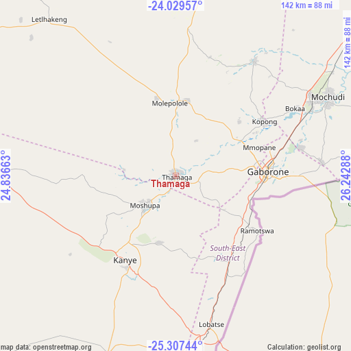
Thamaga GPS coordinates[2]
24° 40' 12.504" South, 25° 32' 23.1" East
| Map corner | latitude | longitude |
|---|---|---|
| Upper-left | -24.02957°, | 24.83663° |
| Center: | -24.67014°, | 25.53975° |
| Lower-right: | -25.30744°, | 26.24288° |
| Map W x H: | 142.1×142.1 km | = 88.3×88.3mi |
| max Lat: | -17.80165° ⇑86.7% North |
| Thamaga: | -24.67014° |
| min Lat: | ⇓13.3% South -26.9° |
| min Long | Thamaga | max Long |
| 20.06667° | 25.53975° | 28.74946° |
| W 35.2%⇐ | ⇒64.8% E |
Elevation
Elevation of Thamaga is 1073 m = 3520 ft, and this is 58 m = 190 ft above average elevation for this country.
| Max E: |
1406 m = 4613 ft | 29.5% |
| Thamaga | 1073 m 3520 ft | |
| Avg. | 1015 m = 3330 ft | |
Min E: |
676 m = 2218 ft | 70.5% |
See also: Botswana elevation on elevation.city.
Geographical zone
Thamaga is located in South temperate zone (between Tropic of Capricorn and the Antarctic Circle). Distance of this Southern Tropic circle is 137.1 km =85.2 mi to North.| Distance of | km | miles | from Thamaga |
|---|---|---|---|
| Equator | 2743.1 | 1704.5 | to North |
| Tropic Capricorn | 137.1 | 85.2 | to North |
| Antarctic Circle | 4658.1 | 2894.4 | to South |
| South Pole | 7264 | 4513.6 | to South |


Nearby cities:
15 places around Thamaga: (largest is in red/bold)
• Dumadumana
35.1 km =21.8 mi,  74°
74°
• Gabane
24.5 km =15.2 mi,  89°
89°
• Gaborone
37.3 km =23.2 mi, 87°
• Galekgatshwane
31.9 km =19.8 mi,  58°
58°
• Gaphatshwe
31.6 km =19.6 mi, 70°
• Kanye
39 km =24.2 mi,  212°
212°
• Metsemotlhaba
29.7 km =18.5 mi, 63°
• Mmokolodi
26.6 km =16.5 mi,  96°
96°
• Mmopone
35.7 km =22.2 mi, 71°
• Mogoditshane
33.3 km =20.7 mi,  81°
81°
• Molepolole
29.7 km =18.5 mi,  351°
351°
• Mononyane
27.4 km =17 mi, 58°
• Mosopa
16.4 km =10.2 mi,  226°
226°
• Nkoyaphiri
29.8 km =18.5 mi, 81°
• Ramotswa
40.2 km =25 mi,  123°
123°
Sources, notices
• [Note1] Compared only with cities in Botswana existing in our database
• [Src1] Map data: © OpenStreetMap contributors (CC-BY-SA)
• [Src2] Other city data from geonames.org with taken over terms of usage.
• [Src3] Geographical zone / Annual Mean Temperature by Robert A. Rohde @ Wikipedia
