Ramokgonami geodata
Ramokgonami (Central) is a populated place; located in Botswana in Africa/Gaborone (GMT+2) time zone. With population of 3,681 people, there are 38 cities with bigger population in this country. Compared to other cities in Botswana, 55.2% of cities are located further ↓South; 85.7% of cities are located further ←West and 82.9% of cities have higher elevation than Ramokgonami. Note1


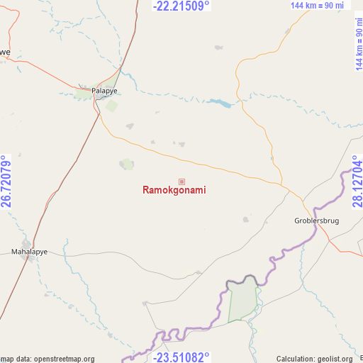
Ramokgonami GPS coordinates[2]
22° 51' 52.2" South, 27° 25' 26.076" East
| Map corner | latitude | longitude |
|---|---|---|
| Upper-left | -22.21509°, | 26.72079° |
| Center: | -22.8645°, | 27.42391° |
| Lower-right: | -23.51082°, | 28.12704° |
| Map W x H: | 144.1×144.1 km | = 89.5×89.5mi |
| max Lat: | -17.80165° ⇑44.8% North |
| Ramokgonami: | -22.8645° |
| min Lat: | ⇓55.2% South -26.9° |
| min Long | Ramokgonami | max Long |
| 20.06667° | 27.42391° | 28.74946° |
| W 85.7%⇐ | ⇒14.3% E |
Elevation
Elevation of Ramokgonami is 915 m = 3002 ft, and this is 100 m = 328 ft below average elevation for this country.
| Max E: |
1406 m = 4613 ft | 82.9% |
| Avg. | 1015 m = 3330 ft | |
| Ramokgonami | 915 m = 3002 ft | |
Min E: |
676 m = 2218 ft | 17.1% |
See also: Botswana elevation on elevation.city.
Geographical zone
Ramokgonami is located in South Torrid zone (between Equator and Tropic of Capricorn). Distance of this Southern Tropic circle is 63.6 km =39.5 mi to South.| Distance of | km | miles | from Ramokgonami |
|---|---|---|---|
| Equator | 2542.3 | 1579.7 | to North |
| Tropic Capricorn | 63.6 | 39.5 | to South |
| Antarctic Circle | 4858.9 | 3019.2 | to South |
| South Pole | 7464.8 | 4638.4 | to South |


Nearby cities:
15 places around Ramokgonami: (largest is in red/bold)
• Letsheng
30.3 km =18.8 mi,  317°
317°
• Maapi
14.1 km =8.8 mi,  327°
327°
• Machaneng
36.4 km =22.6 mi,  169°
169°
• Makobeng
28.9 km =18 mi,  120°
120°
• Makwata
48.3 km =30 mi,  195°
195°
• Malaka
29.3 km =18.2 mi,  340°
340°
• Mathakola
19.7 km =12.2 mi, 323°
• Maunatlala
36.5 km =22.7 mi,  35°
35°
• Mogapinyana
58.2 km =36.2 mi,  18°
18°
• Moremi
32.6 km =20.3 mi,  4°
4°
• Palapye
46.8 km =29.1 mi, 319°
• Pilikwe
24.7 km =15.3 mi,  287°
287°
• Ratholo
21.7 km =13.5 mi, 44°
• Shakgwe
38.8 km =24.1 mi,  225°
225°
• Tamasane
49.7 km =30.9 mi,  357°
357°
Sources, notices
• [Note1] Compared only with cities in Botswana existing in our database
• [Src1] Map data: © OpenStreetMap contributors (CC-BY-SA)
• [Src2] Other city data from geonames.org with taken over terms of usage.
• [Src3] Geographical zone / Annual Mean Temperature by Robert A. Rohde @ Wikipedia
