Maunatlala geodata
Maunatlala (Central) is a populated place; located in Botswana in Africa/Gaborone (GMT+2) time zone. With population of 3,361 people, there are 40 cities with bigger population in this country. Compared to other cities in Botswana, 61.9% of cities are located further ↓South; 93.3% of cities are located further ←West and 91.4% of cities have higher elevation than Maunatlala. Note1


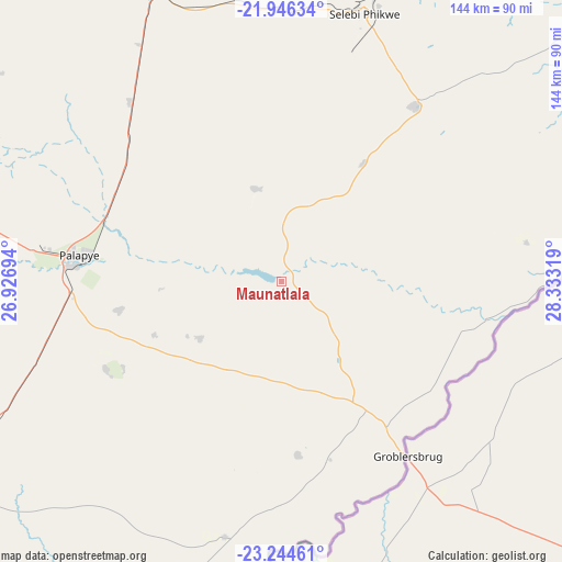
Maunatlala GPS coordinates[2]
22° 35' 49.236" South, 27° 37' 48.216" East
| Map corner | latitude | longitude |
|---|---|---|
| Upper-left | -21.94634°, | 26.92694° |
| Center: | -22.59701°, | 27.63006° |
| Lower-right: | -23.24461°, | 28.33319° |
| Map W x H: | 144.4×144.4 km | = 89.7×89.7mi |
| max Lat: | -17.80165° ⇑38.1% North |
| Maunatlala: | -22.59701° |
| min Lat: | ⇓61.9% South -26.9° |
| min Long | Maunatlala | max Long |
| 20.06667° | 27.63006° | 28.74946° |
| W 93.3%⇐ | ⇒6.7% E |
Elevation
Elevation of Maunatlala is 856 m = 2808 ft, and this is 159 m = 522 ft below average elevation for this country.
| Max E: |
1406 m = 4613 ft | 91.4% |
| Avg. | 1015 m = 3330 ft | |
| Maunatlala | 856 m = 2808 ft | |
Min E: |
676 m = 2218 ft | 8.6% |
See also: Botswana elevation on elevation.city.
Geographical zone
Maunatlala is located in South Torrid zone (between Equator and Tropic of Capricorn). Distance of this Southern Tropic circle is 93.4 km =58 mi to South.| Distance of | km | miles | from Maunatlala |
|---|---|---|---|
| Equator | 2512.6 | 1561.3 | to North |
| Tropic Capricorn | 93.4 | 58 | to South |
| Antarctic Circle | 4888.6 | 3037.6 | to South |
| South Pole | 7494.5 | 4656.9 | to South |


Nearby cities:
15 places around Maunatlala: (largest is in red/bold)
• Letsheng
42.3 km =26.3 mi,  259°
259°
• Maapi
33.8 km =21 mi,  238°
238°
• Machaneng
67.1 km =41.7 mi,  192°
192°
• Makobeng
44.6 km =27.7 mi,  175°
175°
• Malaka
30.9 km =19.2 mi,  266°
266°
• Mathakola
35.6 km =22.1 mi,  247°
247°
• Mogapi
37 km =23 mi,  34°
34°
• Mogapinyana
25.8 km =16 mi,  353°
353°
• Moremi
18.6 km =11.6 mi,  278°
278°
• Palapye
52.2 km =32.4 mi, 276°
• Pilikwe
50.1 km =31.1 mi, 243°
• Ramokgonami
36.5 km =22.7 mi,  215°
215°
• Ratholo
15.4 km =9.6 mi,  202°
202°
• Sefophe
57.6 km =35.8 mi,  36°
36°
• Tamasane
30.8 km =19.1 mi,  310°
310°
Sources, notices
• [Note1] Compared only with cities in Botswana existing in our database
• [Src1] Map data: © OpenStreetMap contributors (CC-BY-SA)
• [Src2] Other city data from geonames.org with taken over terms of usage.
• [Src3] Geographical zone / Annual Mean Temperature by Robert A. Rohde @ Wikipedia
