Machaneng geodata
Machaneng (Central) is a populated place; located in Botswana in Africa/Gaborone (GMT+2) time zone. With population of 2,139 people, there are 52 cities with bigger population in this country. Compared to other cities in Botswana, 51.4% of cities are located further ↑North; 89.5% of cities are located further ←West and 96.2% of cities have higher elevation than Machaneng. Note1


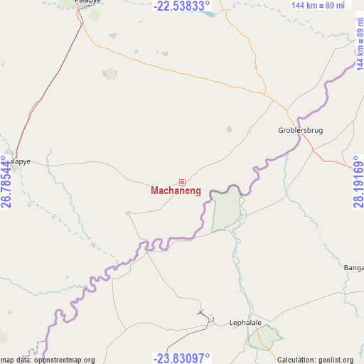
Machaneng GPS coordinates[2]
23° 11' 10.356" South, 27° 29' 18.816" East
| Map corner | latitude | longitude |
|---|---|---|
| Upper-left | -22.53833°, | 26.78544° |
| Center: | -23.18621°, | 27.48856° |
| Lower-right: | -23.83097°, | 28.19169° |
| Map W x H: | 143.7×143.7 km | = 89.3×89.3mi |
| max Lat: | -17.80165° ⇑51.4% North |
| Machaneng: | -23.18621° |
| min Lat: | ⇓48.6% South -26.9° |
| min Long | Machaneng | max Long |
| 20.06667° | 27.48856° | 28.74946° |
| W 89.5%⇐ | ⇒10.5% E |
Elevation
Elevation of Machaneng is 844 m = 2769 ft, and this is 171 m = 561 ft below average elevation for this country.
| Max E: |
1406 m = 4613 ft | 96.2% |
| Avg. | 1015 m = 3330 ft | |
| Machaneng | 844 m = 2769 ft | |
Min E: |
676 m = 2218 ft | 3.8% |
See also: Botswana elevation on elevation.city.
Geographical zone
Machaneng is located in South Torrid zone (between Equator and Tropic of Capricorn). Distance of this Southern Tropic circle is 27.9 km =17.3 mi to South.| Distance of | km | miles | from Machaneng |
|---|---|---|---|
| Equator | 2578.1 | 1602 | to North |
| Tropic Capricorn | 27.9 | 17.3 | to South |
| Antarctic Circle | 4823.1 | 2996.9 | to South |
| South Pole | 7429 | 4616.2 | to South |


Nearby cities:
15 places around Machaneng: (largest is in red/bold)
• Kurametsi
49.2 km =30.6 mi,  241°
241°
• Letsheng
64.1 km =39.8 mi,  334°
334°
• Maapi
49.7 km =30.9 mi,  343°
343°
• Magothla
65.4 km =40.6 mi,  229°
229°
• Makoba
50.3 km =31.3 mi, 228°
• Makobeng
27.9 km =17.3 mi,  40°
40°
• Makwata
22.1 km =13.7 mi, 240°
• Malaka
65.5 km =40.7 mi,  345°
345°
• Mathakola
54.8 km =34.1 mi, 340°
• Maunatlala
67.1 km =41.7 mi,  12°
12°
• Moremi
68.4 km =42.5 mi,  356°
356°
• Pilikwe
52.6 km =32.7 mi,  324°
324°
• Ramokgonami
36.4 km =22.6 mi, 349°
• Ratholo
52 km =32.3 mi, 9°
• Shakgwe
35.5 km =22.1 mi,  284°
284°
Sources, notices
• [Note1] Compared only with cities in Botswana existing in our database
• [Src1] Map data: © OpenStreetMap contributors (CC-BY-SA)
• [Src2] Other city data from geonames.org with taken over terms of usage.
• [Src3] Geographical zone / Annual Mean Temperature by Robert A. Rohde @ Wikipedia
