Moremi geodata
Moremi (Central) is a populated place; located in Botswana in Africa/Gaborone (GMT+2) time zone. With population of 546 people, there are 103 cities with bigger population in this country. Compared to other cities in Botswana, 62.9% of cities are located further ↓South; 87.6% of cities are located further ←West and 87.6% of cities have higher elevation than Moremi. Note1


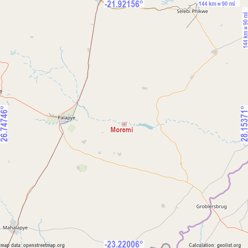
Moremi GPS coordinates[2]
22° 34' 20.424" South, 27° 27' 2.088" East
| Map corner | latitude | longitude |
|---|---|---|
| Upper-left | -21.92156°, | 26.74746° |
| Center: | -22.57234°, | 27.45058° |
| Lower-right: | -23.22006°, | 28.15371° |
| Map W x H: | 144.4×144.4 km | = 89.7×89.7mi |
| max Lat: | -17.80165° ⇑37.1% North |
| Moremi: | -22.57234° |
| min Lat: | ⇓62.9% South -26.9° |
| min Long | Moremi | max Long |
| 20.06667° | 27.45058° | 28.74946° |
| W 87.6%⇐ | ⇒12.4% E |
Elevation
Elevation of Moremi is 886 m = 2907 ft, and this is 129 m = 423 ft below average elevation for this country.
| Max E: |
1406 m = 4613 ft | 87.6% |
| Avg. | 1015 m = 3330 ft | |
| Moremi | 886 m = 2907 ft | |
Min E: |
676 m = 2218 ft | 12.4% |
See also: Botswana elevation on elevation.city.
Geographical zone
Moremi is located in South Torrid zone (between Equator and Tropic of Capricorn). Distance of this Southern Tropic circle is 96.1 km =59.7 mi to South.| Distance of | km | miles | from Moremi |
|---|---|---|---|
| Equator | 2509.8 | 1559.5 | to North |
| Tropic Capricorn | 96.1 | 59.7 | to South |
| Antarctic Circle | 4891.4 | 3039.4 | to South |
| South Pole | 7497.3 | 4658.6 | to South |


Nearby cities:
15 places around Moremi: (largest is in red/bold)
• Letsheng
25.4 km =15.8 mi,  246°
246°
• Maapi
23.1 km =14.4 mi,  206°
206°
• Machaneng
68.4 km =42.5 mi,  176°
176°
• Makobeng
52.1 km =32.4 mi,  154°
154°
• Malaka
13.3 km =8.3 mi, 248°
• Mathakola
21.9 km =13.6 mi,  220°
220°
• Maunatlala
18.6 km =11.6 mi,  98°
98°
• Mogapi
48.3 km =30 mi,  54°
54°
• Mogapinyana
27.5 km =17.1 mi,  33°
33°
• Palapye
33.6 km =20.9 mi,  274°
274°
• Pilikwe
36.5 km =22.7 mi,  226°
226°
• Ramokgonami
32.6 km =20.3 mi, 184°
• Ratholo
21 km =13 mi,  143°
143°
• Shakgwe
66.9 km =41.6 mi, 207°
• Tamasane
17.9 km =11.1 mi,  343°
343°
Sources, notices
• [Note1] Compared only with cities in Botswana existing in our database
• [Src1] Map data: © OpenStreetMap contributors (CC-BY-SA)
• [Src2] Other city data from geonames.org with taken over terms of usage.
• [Src3] Geographical zone / Annual Mean Temperature by Robert A. Rohde @ Wikipedia
