Botlhapatlou geodata
Botlhapatlou (Kweneng) is a populated place; located in Botswana in Africa/Gaborone (GMT+2) time zone. With population of 1,013 people, there are 84 cities with bigger population in this country. Compared to other cities in Botswana, 63.8% of cities are located further ↑North; 66.7% of cities are located further →East and 88.6% of cities have lower elevation than Botlhapatlou. Note1


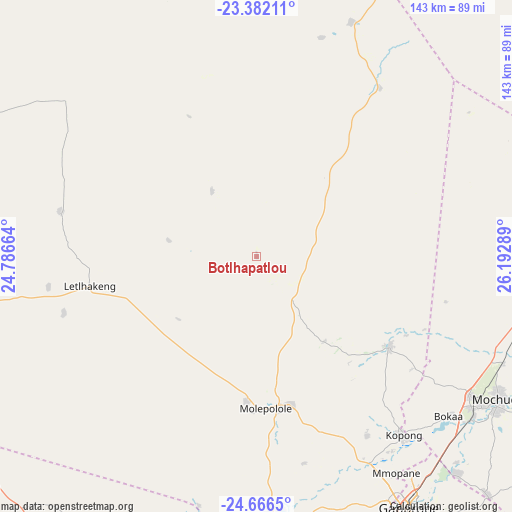
Botlhapatlou GPS coordinates[2]
24° 1' 33.276" South, 25° 29' 23.136" East
| Map corner | latitude | longitude |
|---|---|---|
| Upper-left | -23.38211°, | 24.78664° |
| Center: | -24.02591°, | 25.48976° |
| Lower-right: | -24.6665°, | 26.19289° |
| Map W x H: | 142.8×142.8 km | = 88.7×88.7mi |
| max Lat: | -17.80165° ⇑63.8% North |
| Botlhapatlou: | -24.02591° |
| min Lat: | ⇓36.2% South -26.9° |
| min Long | Botlhapatlou | max Long |
| 20.06667° | 25.48976° | 28.74946° |
| W 33.3%⇐ | ⇒66.7% E |
Elevation
Elevation of Botlhapatlou is 1175 m = 3855 ft, and this is 160 m = 525 ft above average elevation for this country.
| Max E: |
1406 m = 4613 ft | 11.4% |
| Botlhapatlou | 1175 m 3855 ft | |
| Avg. | 1015 m = 3330 ft | |
Min E: |
676 m = 2218 ft | 88.6% |
See also: Botswana elevation on elevation.city.
Geographical zone
Botlhapatlou is located in South temperate zone (between Tropic of Capricorn and the Antarctic Circle). Distance of this Southern Tropic circle is 65.5 km =40.7 mi to North.| Distance of | km | miles | from Botlhapatlou |
|---|---|---|---|
| Equator | 2671.4 | 1659.9 | to North |
| Tropic Capricorn | 65.5 | 40.7 | to North |
| Antarctic Circle | 4729.7 | 2938.9 | to South |
| South Pole | 7335.6 | 4558.1 | to South |


Nearby cities:
15 places around Botlhapatlou: (largest is in red/bold)
• Boatlaname
58.9 km =36.6 mi,  36°
36°
• Bokaa
71.3 km =44.3 mi,  131°
131°
• Dumadumana
73.6 km =45.7 mi,  148°
148°
• Galekgatshwane
63.6 km =39.5 mi, 149°
• Gaphatshwe
70.2 km =43.6 mi, 150°
• Kgaphamadi
72.2 km =44.9 mi,  142°
142°
• Kopong
64.6 km =40.1 mi, 141°
• Lenchwe Le Tau
54 km =33.6 mi, 137°
• Letlhakeng
47.3 km =29.4 mi,  260°
260°
• Metsemotlhaba
66.5 km =41.3 mi, 151°
• Mmopone
71.7 km =44.6 mi, 147°
• Molepolole
42.3 km =26.3 mi,  179°
179°
• Mononyane
64.1 km =39.8 mi, 153°
• Nkoyaphiri
75.8 km =47.1 mi, 152°
• Thamaga
71.8 km =44.6 mi, 175°
Sources, notices
• [Note1] Compared only with cities in Botswana existing in our database
• [Src1] Map data: © OpenStreetMap contributors (CC-BY-SA)
• [Src2] Other city data from geonames.org with taken over terms of usage.
• [Src3] Geographical zone / Annual Mean Temperature by Robert A. Rohde @ Wikipedia
