Boatlaname geodata
Boatlaname is a populated place; located in Botswana in Africa/Gaborone (GMT+2) time zone. With population of 853 people, there are 91 cities with bigger population in this country. Compared to other cities in Botswana, 57.1% of cities are located further ↑North; 52.4% of cities are located further →East and 63.8% of cities have lower elevation than Boatlaname. Note1


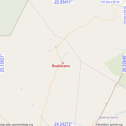
Boatlaname GPS coordinates[2]
23° 36' 0" South, 25° 49' 59.988" East
| Map corner | latitude | longitude |
|---|---|---|
| Upper-left | -22.95411°, | 25.13021° |
| Center: | -23.6°, | 25.83333° |
| Lower-right: | -24.24272°, | 26.53646° |
| Map W x H: | 143.3×143.3 km | = 89×89mi |
| max Lat: | -17.80165° ⇑57.1% North |
| Boatlaname: | -23.6° |
| min Lat: | ⇓42.9% South -26.9° |
| min Long | Boatlaname | max Long |
| 20.06667° | 25.83333° | 28.74946° |
| W 47.6%⇐ | ⇒52.4% E |
Elevation
Elevation of Boatlaname is 1050 m = 3445 ft, and this is 35 m = 115 ft above average elevation for this country.
| Max E: |
1406 m = 4613 ft | 36.2% |
| Boatlaname | 1050 m 3445 ft | |
| Avg. | 1015 m = 3330 ft | |
Min E: |
676 m = 2218 ft | 63.8% |
See also: Botswana elevation on elevation.city.
Geographical zone
Boatlaname is located in South temperate zone (between Tropic of Capricorn and the Antarctic Circle). Distance of this Southern Tropic circle is 18.2 km =11.3 mi to North.| Distance of | km | miles | from Boatlaname |
|---|---|---|---|
| Equator | 2624.1 | 1630.5 | to North |
| Tropic Capricorn | 18.2 | 11.3 | to North |
| Antarctic Circle | 4777.1 | 2968.4 | to South |
| South Pole | 7383 | 4587.6 | to South |


Nearby cities:
15 places around Boatlaname: (largest is in red/bold)
• Bokaa
96.3 km =59.8 mi,  168°
168°
• Bonwapitse
103.1 km =64.1 mi,  52°
52°
• Botlhapatlou
58.9 km =36.6 mi,  216°
216°
• Galekgatshwane
102.2 km =63.5 mi,  181°
181°
• Kalamare
105.6 km =65.6 mi, 45°
• Kgaphamadi
104.7 km =65.1 mi, 174°
• Kopong
98.3 km =61.1 mi, 177°
• Lenchwe Le Tau
87.1 km =54.1 mi, 178°
• Letlhakeng
98.5 km =61.2 mi,  236°
236°
• Metsemotlhaba
105.8 km =65.7 mi, 181°
• Mochudi
96.3 km =59.8 mi,  160°
160°
• Molepolole
96 km =59.7 mi,  200°
200°
• Mononyane
104.9 km =65.2 mi, 183°
• Mookane
84.7 km =52.6 mi,  96°
96°
• Pilane
99.3 km =61.7 mi, 162°
Sources, notices
• [Note1] Compared only with cities in Botswana existing in our database
• [Src1] Map data: © OpenStreetMap contributors (CC-BY-SA)
• [Src2] Other city data from geonames.org with taken over terms of usage.
• [Src3] Geographical zone / Annual Mean Temperature by Robert A. Rohde @ Wikipedia
