Barrhead geodata
Barrhead (Alberta) is a populated place; located in Canada in America/Edmonton (GMT-6) time zone. With population of 4,430 people, there are 506 cities with bigger population in this country. Compared to other cities in Canada, 93.5% of cities are located further ↓South; 82.4% of cities are located further →East and 89.3% of cities have lower elevation than Barrhead. Note1


Barrhead GPS coordinates[2]
54° 8' 0.42" North, 114° 24' 7.596" West
| Map corner | latitude | longitude |
|---|---|---|
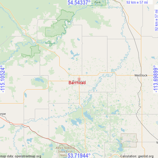
| Upper-left | 54.54337°, | -115.10524° |
| Center: | 54.13345°, | -114.40211° |
| Lower-right: | 53.71944°, | -113.69899° |
| Map W x H: | 91.6×91.6 km | = 56.9×56.9mi |
| max Lat: | 73.03752° ⇑6.5% North |
| Barrhead: | 54.13345° |
| min Lat: | ⇓93.5% South 42.05009° |
| min Long | Barrhead | max Long |
| -139.43328° | -114.40211° | -52.70931° |
| W 17.6%⇐ | ⇒82.4% E |
Elevation
Elevation of Barrhead is 656 m = 2152 ft, and this is 401.6 m = 1318 ft above average elevation for this country.
| Max E: |
1518 m = 4980 ft | 10.7% |
| Barrhead | 656 m 2152 ft | |
| Avg. | 254.4 m = 835 ft | |
Min E: |
-2 m = -7 ft | 89.3% |
See also: Canada elevation on elevation.city.
Geographical zone
Barrhead is located in North temperate zone (between Tropic of Cancer and the Arctic Circle). Distance of this North polar circle is 1382.1 km =858.8 mi to North.| Distance of | km | miles | from Barrhead |
|---|---|---|---|
| North Pole | 3988 | 2478 | to North |
| Arctic Circle | 1382.1 | 858.8 | to North |
| Tropic Cancer | 3413.2 | 2120.9 | to South |
| Equator | 6019.1 | 3740.1 | to South |


Nearby cities:
15 places around Barrhead: (largest is in red/bold)
• Athabasca
97.1 km =60.3 mi,  48°
48°
• Bon Accord
72.4 km =45 mi,  117°
117°
• Devon
95.9 km =59.6 mi,  152°
152°
• Edmonton
89.2 km =55.4 mi,  136°
136°
• Fort Saskatchewan
90.3 km =56.1 mi, 120°
• Gibbons
77.3 km =48 mi, 115°
• Mayerthorpe
52 km =32.3 mi,  246°
246°
• Morinville
61.5 km =38.2 mi,  127°
127°
• Rideau Park
93.6 km =58.2 mi, 141°
• Spruce Grove
73.9 km =45.9 mi, 154°
• St. Albert
74.9 km =46.5 mi, 137°
• Stony Plain
71.7 km =44.6 mi,  158°
158°
• Swan Hills
91.6 km =56.9 mi,  315°
315°
• Westlock
34.8 km =21.6 mi,  86°
86°
• Whitecourt
83.6 km =51.9 mi,  271°
271°
Sources, notices
• [Note1] Compared only with cities in Canada existing in our database
• [Src1] Map data: © OpenStreetMap contributors (CC-BY-SA)
• [Src2] Other city data from geonames.org with taken over terms of usage.
• [Src3] Geographical zone / Annual Mean Temperature by Robert A. Rohde @ Wikipedia
