Whitecourt geodata
Whitecourt (Alberta) is a populated place; located in Canada in America/Edmonton (GMT-6) time zone. With population of 8,763 people, there are 344 cities with bigger population in this country. Compared to other cities in Canada, 93.7% of cities are located further ↓South; 83.8% of cities are located further →East and 91.1% of cities have lower elevation than Whitecourt. Note1


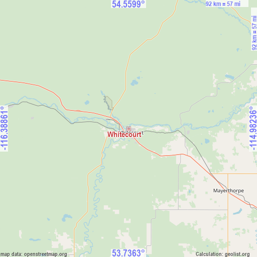
Whitecourt GPS coordinates[2]
54° 9' 0.54" North, 115° 41' 7.728" West
| Map corner | latitude | longitude |
|---|---|---|
| Upper-left | 54.5599°, | -116.38861° |
| Center: | 54.15015°, | -115.68548° |
| Lower-right: | 53.7363°, | -114.98236° |
| Map W x H: | 91.6×91.6 km | = 56.9×56.9mi |
| max Lat: | 73.03752° ⇑6.3% North |
| Whitecourt: | 54.15015° |
| min Lat: | ⇓93.7% South 42.05009° |
| min Long | Whitecourt | max Long |
| -139.43328° | -115.68548° | -52.70931° |
| W 16.2%⇐ | ⇒83.8% E |
Elevation
Elevation of Whitecourt is 689 m = 2260 ft, and this is 434.6 m = 1426 ft above average elevation for this country.
| Max E: |
1518 m = 4980 ft | 8.9% |
| Whitecourt | 689 m 2260 ft | |
| Avg. | 254.4 m = 835 ft | |
Min E: |
-2 m = -7 ft | 91.1% |
See also: Canada elevation on elevation.city.
Geographical zone
Whitecourt is located in North temperate zone (between Tropic of Cancer and the Arctic Circle). Distance of this North polar circle is 1380.2 km =857.6 mi to North.| Distance of | km | miles | from Whitecourt |
|---|---|---|---|
| North Pole | 3986.1 | 2476.8 | to North |
| Arctic Circle | 1380.2 | 857.6 | to North |
| Tropic Cancer | 3415 | 2122 | to South |
| Equator | 6020.9 | 3741.2 | to South |


Nearby cities:
15 places around Whitecourt: (largest is in red/bold)
• Barrhead
83.6 km =51.9 mi,  91°
91°
• Drayton Valley
113.6 km =70.6 mi,  156°
156°
• Edson
79.9 km =49.6 mi,  217°
217°
• Fox Creek
77.7 km =48.3 mi,  290°
290°
• High Prairie
151.6 km =94.2 mi,  340°
340°
• Hinton
150.1 km =93.3 mi,  236°
236°
• Mayerthorpe
42.2 km =26.2 mi,  121°
121°
• Morinville
138.5 km =86.1 mi,  106°
106°
• Slave Lake
139.1 km =86.4 mi,  25°
25°
• Spruce Grove
134.7 km =83.7 mi, 120°
• St. Albert
146.1 km =90.8 mi, 113°
• Stony Plain
130 km =80.8 mi, 121°
• Swan Hills
65.6 km =40.8 mi,  16°
16°
• Valleyview
144.9 km =90 mi,  314°
314°
• Westlock
118.3 km =73.5 mi, 89°
Sources, notices
• [Note1] Compared only with cities in Canada existing in our database
• [Src1] Map data: © OpenStreetMap contributors (CC-BY-SA)
• [Src2] Other city data from geonames.org with taken over terms of usage.
• [Src3] Geographical zone / Annual Mean Temperature by Robert A. Rohde @ Wikipedia
