King geodata
King (Ontario) is a populated place; located in Canada in America/Toronto (GMT-4) time zone. With population of 6,970 people, there are 404 cities with bigger population in this country. Compared to other cities in Canada, 92% of cities are located further ↑North; 53.7% of cities are located further →East and 71% of cities have lower elevation than King. Note1


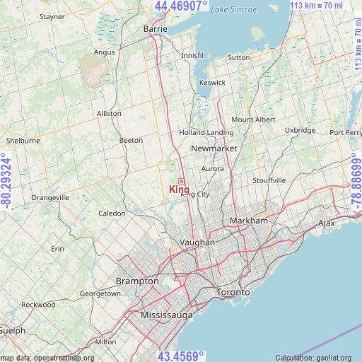
King GPS coordinates[2]
43° 57' 54.504" North, 79° 35' 24.396" West
| Map corner | latitude | longitude |
|---|---|---|
| Upper-left | 44.46907°, | -80.29324° |
| Center: | 43.96514°, | -79.59011° |
| Lower-right: | 43.4569°, | -78.88699° |
| Map W x H: | 112.5×112.5 km | = 69.9×69.9mi |
| max Lat: | 73.03752° ⇑92% North |
| King: | 43.96514° |
| min Lat: | ⇓8% South 42.05009° |
| min Long | King | max Long |
| -139.43328° | -79.59011° | -52.70931° |
| W 46.3%⇐ | ⇒53.7% E |
Elevation
Elevation of King is 311 m = 1020 ft, and this is 56.6 m = 186 ft above average elevation for this country.
| Max E: |
1518 m = 4980 ft | 29% |
| King | 311 m 1020 ft | |
| Avg. | 254.4 m = 835 ft | |
Min E: |
-2 m = -7 ft | 71% |
See also: Canada elevation on elevation.city.
Geographical zone
King is located in North temperate zone (between Tropic of Cancer and the Arctic Circle). Distance of this Northern Tropic circle is 2282.5 km =1418.3 mi to South.| Distance of | km | miles | from King |
|---|---|---|---|
| North Pole | 5118.6 | 3180.5 | to North |
| Arctic Circle | 2512.7 | 1561.3 | to North |
| Tropic Cancer | 2282.5 | 1418.3 | to South |
| Equator | 4888.5 | 3037.6 | to South |


Nearby cities:
15 places around King: (largest is in red/bold)
• Alliston
30.2 km =18.8 mi,  312°
312°
• Aurora
10.6 km =6.6 mi,  68°
68°
• Ballantrae
24.4 km =15.2 mi, 71°
• Concord
20.3 km =12.6 mi,  154°
154°
• Cookstown
25.8 km =16 mi,  340°
340°
• East Gwillimbury
19.4 km =12.1 mi,  38°
38°
• Goodwood
32.1 km =19.9 mi,  76°
76°
• Markham
28.1 km =17.5 mi,  112°
112°
• Mount Albert
28.8 km =17.9 mi,  49°
49°
• Newmarket
13.7 km =8.5 mi, 46°
• North York
26.1 km =16.2 mi, 147°
• Richmond Hill
16.1 km =10 mi,  130°
130°
• Tottenham
18.4 km =11.4 mi,  290°
290°
• Vaughan
16.1 km =10 mi, 152°
• Willowdale
26.9 km =16.7 mi, 145°
Sources, notices
• [Note1] Compared only with cities in Canada existing in our database
• [Src1] Map data: © OpenStreetMap contributors (CC-BY-SA)
• [Src2] Other city data from geonames.org with taken over terms of usage.
• [Src3] Geographical zone / Annual Mean Temperature by Robert A. Rohde @ Wikipedia
