Lakefield geodata
Lakefield (Ontario) is a populated place; located in Canada in America/Toronto (GMT-4) time zone. With population of 2,753 people, there are 644 cities with bigger population in this country. Compared to other cities in Canada, 88% of cities are located further ↑North; 51.5% of cities are located further ←West and 62.3% of cities have lower elevation than Lakefield. Note1
Administrative division(s):
- Level 1: Ontario
- Level 2: Peterborough County
- Level 3: Township of Selwyn


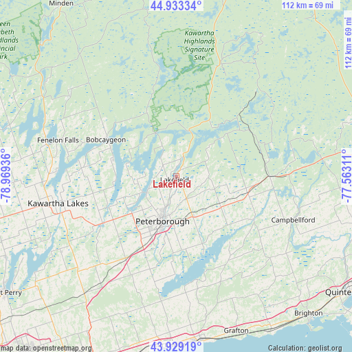
Lakefield GPS coordinates[2]
44° 26' 0.312" North, 78° 15' 58.428" West
| Map corner | latitude | longitude |
|---|---|---|
| Upper-left | 44.93334°, | -78.96936° |
| Center: | 44.43342°, | -78.26623° |
| Lower-right: | 43.92919°, | -77.56311° |
| Map W x H: | 111.7×111.6 km | = 69.4×69.3mi |
| max Lat: | 73.03752° ⇑88% North |
| Lakefield: | 44.43342° |
| min Lat: | ⇓12% South 42.05009° |
| min Long | Lakefield | max Long |
| -139.43328° | -78.26623° | -52.70931° |
| W 51.5%⇐ | ⇒48.5% E |
Elevation
Elevation of Lakefield is 241 m = 791 ft, and this is 13.4 m = 44 ft below average elevation for this country.
| Max E: |
1518 m = 4980 ft | 37.7% |
| Avg. | 254.4 m = 835 ft | |
| Lakefield | 241 m = 791 ft | |
Min E: |
-2 m = -7 ft | 62.3% |
See also: Canada elevation on elevation.city.
Geographical zone
Lakefield is located in North temperate zone (between Tropic of Cancer and the Arctic Circle). Distance of this Northern Tropic circle is 2334.6 km =1450.7 mi to South.| Distance of | km | miles | from Lakefield |
|---|---|---|---|
| North Pole | 5066.5 | 3148.2 | to North |
| Arctic Circle | 2460.6 | 1528.9 | to North |
| Tropic Cancer | 2334.6 | 1450.7 | to South |
| Equator | 4940.5 | 3069.9 | to South |


Nearby cities:
15 places around Lakefield: (largest is in red/bold)
• Blackstock
57.4 km =35.7 mi,  229°
229°
• Caesarea
55 km =34.2 mi,  235°
235°
• Cobourg
53.3 km =33.1 mi,  171°
171°
• Greenbank
67.5 km =41.9 mi, 242°
• Haliburton Village
71.6 km =44.5 mi,  343°
343°
• Lindsay
38.2 km =23.7 mi,  255°
255°
• Madoc
63.4 km =39.4 mi,  82°
82°
• Millbrook
34.7 km =21.6 mi,  204°
204°
• Norwood
23.2 km =14.4 mi,  103°
103°
• Omemee
27.7 km =17.2 mi, 237°
• Oshawa
75.4 km =46.9 mi,  218°
218°
• Peterborough
15.3 km =9.5 mi, 195°
• Port Hope
47.5 km =29.5 mi,  192°
192°
• Quinte West
62.3 km =38.7 mi,  116°
116°
• Stirling
58.9 km =36.6 mi, 104°
Sources, notices
• [Note1] Compared only with cities in Canada existing in our database
• [Src1] Map data: © OpenStreetMap contributors (CC-BY-SA)
• [Src2] Other city data from geonames.org with taken over terms of usage.
• [Src3] Geographical zone / Annual Mean Temperature by Robert A. Rohde @ Wikipedia
