Macklin geodata
Macklin (Saskatchewan) is a populated place; located in Canada in America/Regina (GMT-6) time zone. With population of 1,257 people, there are 931 cities with bigger population in this country. Compared to other cities in Canada, 87.4% of cities are located further ↓South; 74.7% of cities are located further →East and 90.3% of cities have lower elevation than Macklin. Note1


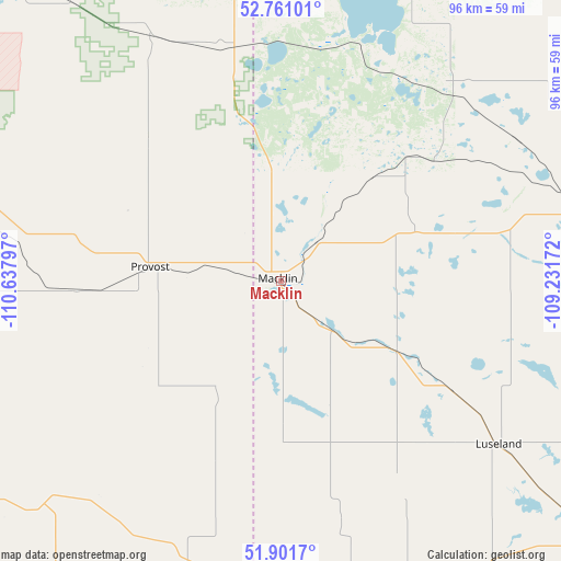
Macklin GPS coordinates[2]
52° 20' 0.384" North, 109° 56' 5.424" West
| Map corner | latitude | longitude |
|---|---|---|
| Upper-left | 52.76101°, | -110.63797° |
| Center: | 52.33344°, | -109.93484° |
| Lower-right: | 51.9017°, | -109.23172° |
| Map W x H: | 95.5×95.5 km | = 59.3×59.3mi |
| max Lat: | 73.03752° ⇑12.6% North |
| Macklin: | 52.33344° |
| min Lat: | ⇓87.4% South 42.05009° |
| min Long | Macklin | max Long |
| -139.43328° | -109.93484° | -52.70931° |
| W 25.3%⇐ | ⇒74.7% E |
Elevation
Elevation of Macklin is 674 m = 2211 ft, and this is 419.6 m = 1377 ft above average elevation for this country.
| Max E: |
1518 m = 4980 ft | 9.7% |
| Macklin | 674 m 2211 ft | |
| Avg. | 254.4 m = 835 ft | |
Min E: |
-2 m = -7 ft | 90.3% |
See also: Canada elevation on elevation.city.
Geographical zone
Macklin is located in North temperate zone (between Tropic of Cancer and the Arctic Circle). Distance of this North polar circle is 1582.2 km =983.1 mi to North.| Distance of | km | miles | from Macklin |
|---|---|---|---|
| North Pole | 4188.1 | 2602.4 | to North |
| Arctic Circle | 1582.2 | 983.1 | to North |
| Tropic Cancer | 3213 | 1996.5 | to South |
| Equator | 5818.9 | 3615.7 | to South |


Nearby cities:
15 places around Macklin: (largest is in red/bold)
• Biggar
135.1 km =83.9 mi,  102°
102°
• Eston
154.8 km =96.2 mi,  148°
148°
• Hanna
155.6 km =96.7 mi,  239°
239°
• Kerrobert
71.6 km =44.5 mi,  130°
130°
• Killam
138.9 km =86.3 mi,  291°
291°
• Kindersley
109.8 km =68.2 mi, 151°
• Lloydminster
104.6 km =65 mi,  356°
356°
• Mannville
138.7 km =86.2 mi,  323°
323°
• North Battleford
121.3 km =75.4 mi,  65°
65°
• Provost
22.7 km =14.1 mi,  274°
274°
• Unity
53.6 km =33.3 mi,  75°
75°
• Vermilion
129.3 km =80.3 mi,  331°
331°
• Viking
150.1 km =93.3 mi,  304°
304°
• Wainwright
83.4 km =51.8 mi,  311°
311°
• Wilkie
84.2 km =52.3 mi, 83°
Sources, notices
• [Note1] Compared only with cities in Canada existing in our database
• [Src1] Map data: © OpenStreetMap contributors (CC-BY-SA)
• [Src2] Other city data from geonames.org with taken over terms of usage.
• [Src3] Geographical zone / Annual Mean Temperature by Robert A. Rohde @ Wikipedia
