North Cowichan geodata
North Cowichan (British Columbia) is a populated place; located in Canada in America/Vancouver (GMT-7) time zone. With population of 32,272 people, there are 139 cities with bigger population in this country. Compared to other cities in Canada, 60.8% of cities are located further ↓South; 95.4% of cities are located further →East and 54.1% of cities have higher elevation than North Cowichan. Note1
Administrative division(s):
- Level 1: British Columbia
- Level 2: Cowichan Valley Regional District
- Level 3: North Cowichan


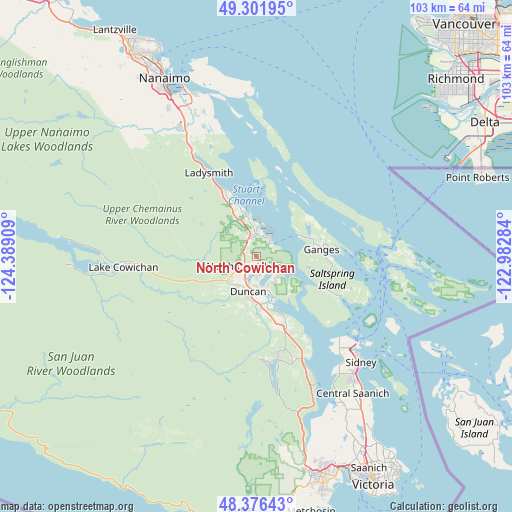
North Cowichan GPS coordinates[2]
48° 50' 28.788" North, 123° 41' 9.456" West
| Map corner | latitude | longitude |
|---|---|---|
| Upper-left | 49.30195°, | -124.38909° |
| Center: | 48.84133°, | -123.68596° |
| Lower-right: | 48.37643°, | -122.98284° |
| Map W x H: | 102.9×102.9 km | = 63.9×63.9mi |
| max Lat: | 73.03752° ⇑39.2% North |
| North Cowichan: | 48.84133° |
| min Lat: | ⇓60.8% South 42.05009° |
| min Long | North Cowichan | max Long |
| -139.43328° | -123.68596° | -52.70931° |
| W 4.6%⇐ | ⇒95.4% E |
Elevation
Elevation of North Cowichan is 145 m = 476 ft, and this is 109.4 m = 359 ft below average elevation for this country.
| Max E: |
1518 m = 4980 ft | 54.1% |
| Avg. | 254.4 m = 835 ft | |
| North Cowichan | 145 m = 476 ft | |
Min E: |
-2 m = -7 ft | 45.9% |
See also: Canada elevation on elevation.city.
Geographical zone
North Cowichan is located in North temperate zone (between Tropic of Cancer and the Arctic Circle). Distance of this North polar circle is 1970.5 km =1224.4 mi to North.| Distance of | km | miles | from North Cowichan |
|---|---|---|---|
| North Pole | 4576.4 | 2843.6 | to North |
| Arctic Circle | 1970.5 | 1224.4 | to North |
| Tropic Cancer | 2824.7 | 1755.2 | to South |
| Equator | 5430.6 | 3374.4 | to South |


Nearby cities:
15 places around North Cowichan: (largest is in red/bold)
• Cassidy
27.4 km =17 mi,  327°
327°
• Cedar
32.9 km =20.4 mi,  338°
338°
• Chemainus
8.7 km =5.4 mi, 343°
• Cherry Point
17.1 km =10.6 mi,  147°
147°
• Cowichan Bay
13 km =8.1 mi,  157°
157°
• Duncan
6.6 km =4.1 mi,  190°
190°
• East Wellington
44.2 km =27.5 mi, 326°
• Ladysmith
19.1 km =11.9 mi, 329°
• Lake Cowichan
27 km =16.8 mi,  266°
266°
• Nanaimo
40.6 km =25.2 mi, 332°
• North Oyster/Yellow Point
25.4 km =15.8 mi, 334°
• North Saanich
27.6 km =17.1 mi,  134°
134°
• Salt Spring Island
14.5 km =9 mi,  100°
100°
• Saltair
13.5 km =8.4 mi, 333°
• Youbou
37.9 km =23.5 mi, 274°
Sources, notices
• [Note1] Compared only with cities in Canada existing in our database
• [Src1] Map data: © OpenStreetMap contributors (CC-BY-SA)
• [Src2] Other city data from geonames.org with taken over terms of usage.
• [Src3] Geographical zone / Annual Mean Temperature by Robert A. Rohde @ Wikipedia
