Powerview geodata
Powerview (Manitoba) is a populated place; located in Canada in America/Winnipeg (GMT-5) time zone. With population of 684 people, there are 1123 cities with bigger population in this country. Compared to other cities in Canada, 79.7% of cities are located further ↓South; 65.4% of cities are located further →East and 59.2% of cities have lower elevation than Powerview. Note1


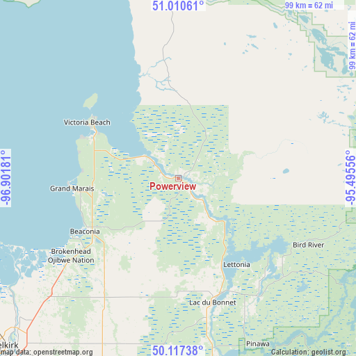
Powerview GPS coordinates[2]
50° 33' 57.996" North, 96° 11' 55.248" West
| Map corner | latitude | longitude |
|---|---|---|
| Upper-left | 51.01061°, | -96.90181° |
| Center: | 50.56611°, | -96.19868° |
| Lower-right: | 50.11738°, | -95.49556° |
| Map W x H: | 99.3×99.3 km | = 61.7×61.7mi |
| max Lat: | 73.03752° ⇑20.3% North |
| Powerview: | 50.56611° |
| min Lat: | ⇓79.7% South 42.05009° |
| min Long | Powerview | max Long |
| -139.43328° | -96.19868° | -52.70931° |
| W 34.6%⇐ | ⇒65.4% E |
Elevation
Elevation of Powerview is 228 m = 748 ft, and this is 26.4 m = 87 ft below average elevation for this country.
| Max E: |
1518 m = 4980 ft | 40.8% |
| Avg. | 254.4 m = 835 ft | |
| Powerview | 228 m = 748 ft | |
Min E: |
-2 m = -7 ft | 59.2% |
See also: Canada elevation on elevation.city.
Geographical zone
Powerview is located in North temperate zone (between Tropic of Cancer and the Arctic Circle). Distance of this North polar circle is 1778.7 km =1105.2 mi to North.| Distance of | km | miles | from Powerview |
|---|---|---|---|
| North Pole | 4384.6 | 2724.5 | to North |
| Arctic Circle | 1778.7 | 1105.2 | to North |
| Tropic Cancer | 3016.5 | 1874.4 | to South |
| Equator | 5622.4 | 3493.6 | to South |


Nearby cities:
15 places around Powerview: (largest is in red/bold)
• Beausejour
60.4 km =37.5 mi,  201°
201°
• Garson
65.2 km =40.5 mi,  213°
213°
• Gimli
56.4 km =35 mi,  277°
277°
• Headingley
115.4 km =71.7 mi,  228°
228°
• Ile des Chênes
110.5 km =68.7 mi, 210°
• La Broquerie
118.6 km =73.7 mi,  190°
190°
• Lac du Bonnet
36.1 km =22.4 mi,  164°
164°
• Landmark
108.9 km =67.7 mi, 204°
• Lorette
103.7 km =64.4 mi, 207°
• Pine Falls
1.4 km =0.9 mi,  271°
271°
• Selkirk
67.6 km =42 mi, 226°
• Stonewall
93.3 km =58 mi,  239°
239°
• Tyndall
62.9 km =39.1 mi, 211°
• Warren
107.2 km =66.6 mi, 243°
• Winnipeg
101.5 km =63.1 mi,  221°
221°
Sources, notices
• [Note1] Compared only with cities in Canada existing in our database
• [Src1] Map data: © OpenStreetMap contributors (CC-BY-SA)
• [Src2] Other city data from geonames.org with taken over terms of usage.
• [Src3] Geographical zone / Annual Mean Temperature by Robert A. Rohde @ Wikipedia
