Rankin Inlet geodata
Rankin Inlet (Nunavut) is a populated locality; located in Canada in America/Rankin_Inlet (GMT-5) time zone. With population of 2,334 people, there are 697 cities with bigger population in this country. Compared to other cities in Canada, 98.7% of cities are located further ↓South; 64.5% of cities are located further →East and 99.7% of cities have higher elevation than Rankin Inlet. Note1


Rankin Inlet GPS coordinates[2]
62° 48' 32.616" North, 92° 5' 7.224" West
| Map corner | latitude | longitude |
|---|---|---|
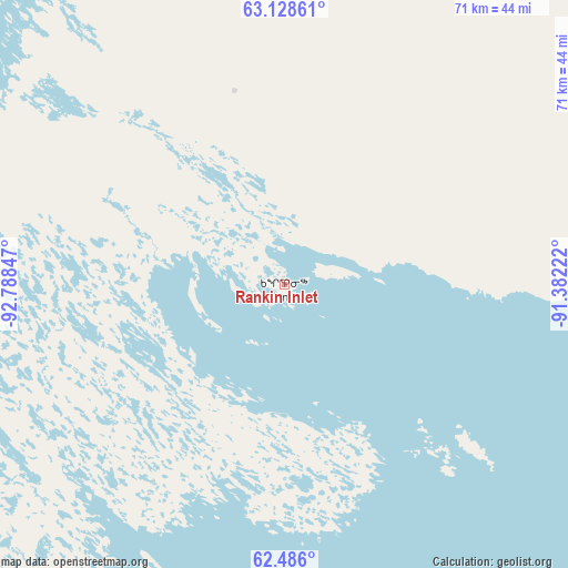
| Upper-left | 63.12861°, | -92.78847° |
| Center: | 62.80906°, | -92.08534° |
| Lower-right: | 62.486°, | -91.38222° |
| Map W x H: | 71.5×71.4 km | = 44.4×44.4mi |
| max Lat: | 73.03752° ⇑1.3% North |
| Rankin Inlet: | 62.80906° |
| min Lat: | ⇓98.7% South 42.05009° |
| min Long | Rankin Inlet | max Long |
| -139.43328° | -92.08534° | -52.70931° |
| W 35.5%⇐ | ⇒64.5% E |
Elevation
Elevation of Rankin Inlet is 1 m = 3 ft, and this is 253.4 m = 831 ft below average elevation for this country.
| Max E: |
1518 m = 4980 ft | 99.7% |
| Avg. | 254.4 m = 835 ft | |
| Rankin Inlet | 1 m = 3 ft | |
Min E: |
-2 m = -7 ft | 0.3% |
See also: Canada elevation on elevation.city.
Geographical zone
Rankin Inlet is located in North temperate zone (between Tropic of Cancer and the Arctic Circle). Distance of this North polar circle is 417.5 km =259.4 mi to North.| Distance of | km | miles | from Rankin Inlet |
|---|---|---|---|
| North Pole | 3023.3 | 1878.6 | to North |
| Arctic Circle | 417.5 | 259.4 | to North |
| Tropic Cancer | 4377.8 | 2720.2 | to South |
| Equator | 6983.7 | 4339.5 | to South |


Nearby cities:
15 places around Rankin Inlet: (largest is in red/bold)
• Arctic Bay
1171.8 km =728.1 mi,  14°
14°
• Behchokǫ̀
1210.5 km =752.2 mi,  269°
269°
• Cranberry Portage
1057.9 km =657.3 mi,  210°
210°
• Cross Lake 19A
963.6 km =598.8 mi,  199°
199°
• Flin Flon
1054.7 km =655.4 mi, 212°
• Fort Smith
1094 km =679.8 mi,  253°
253°
• Gjoa Haven
669.3 km =415.9 mi,  345°
345°
• Iqaluit
1176.2 km =730.9 mi,  84°
84°
• Kugluktuk
1195.5 km =742.8 mi,  297°
297°
• La Ronge
1139.2 km =707.9 mi,  221°
221°
• Pelican Narrows
1049.8 km =652.3 mi, 216°
• Salluit
844.3 km =524.6 mi,  94°
94°
• The Pas
1130.9 km =702.7 mi, 208°
• Thompson
850.5 km =528.5 mi, 202°
• Yellowknife
1134.2 km =704.8 mi, 268°
Sources, notices
• [Note1] Compared only with cities in Canada existing in our database
• [Src1] Map data: © OpenStreetMap contributors (CC-BY-SA)
• [Src2] Other city data from geonames.org with taken over terms of usage.
• [Src3] Geographical zone / Annual Mean Temperature by Robert A. Rohde @ Wikipedia
