Sioux Lookout geodata
Sioux Lookout (Ontario) is a populated place; located in Canada in America/Winnipeg (GMT-5) time zone. With population of 2,941 people, there are 620 cities with bigger population in this country. Compared to other cities in Canada, 76.3% of cities are located further ↓South; 64.4% of cities are located further →East and 78.5% of cities have lower elevation than Sioux Lookout. Note1


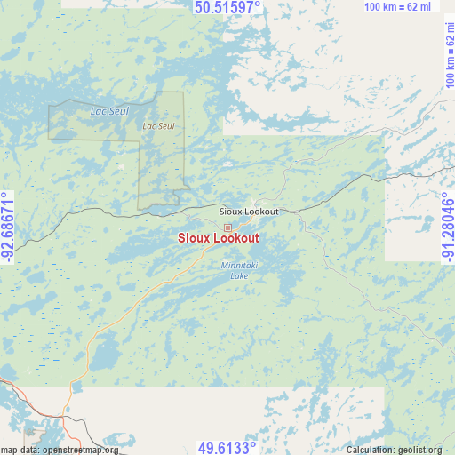
Sioux Lookout GPS coordinates[2]
50° 4' 0.336" North, 91° 59' 0.888" West
| Map corner | latitude | longitude |
|---|---|---|
| Upper-left | 50.51597°, | -92.68671° |
| Center: | 50.06676°, | -91.98358° |
| Lower-right: | 49.6133°, | -91.28046° |
| Map W x H: | 100.4×100.4 km | = 62.4×62.4mi |
| max Lat: | 73.03752° ⇑23.7% North |
| Sioux Lookout: | 50.06676° |
| min Lat: | ⇓76.3% South 42.05009° |
| min Long | Sioux Lookout | max Long |
| -139.43328° | -91.98358° | -52.70931° |
| W 35.6%⇐ | ⇒64.4% E |
Elevation
Elevation of Sioux Lookout is 412 m = 1352 ft, and this is 157.6 m = 517 ft above average elevation for this country.
| Max E: |
1518 m = 4980 ft | 21.5% |
| Sioux Lookout | 412 m 1352 ft | |
| Avg. | 254.4 m = 835 ft | |
Min E: |
-2 m = -7 ft | 78.5% |
See also: Canada elevation on elevation.city.
Geographical zone
Sioux Lookout is located in North temperate zone (between Tropic of Cancer and the Arctic Circle). Distance of this North polar circle is 1834.3 km =1139.8 mi to North.| Distance of | km | miles | from Sioux Lookout |
|---|---|---|---|
| North Pole | 4440.2 | 2759 | to North |
| Arctic Circle | 1834.3 | 1139.8 | to North |
| Tropic Cancer | 2961 | 1839.9 | to South |
| Equator | 5566.9 | 3459.1 | to South |


Nearby cities:
12 places around Sioux Lookout: (largest is in red/bold)
• Atikokan
148 km =92 mi,  169°
169°
• Dryden
63.3 km =39.3 mi,  240°
240°
• Ear Falls
109.3 km =67.9 mi,  305°
305°
• Fort Frances
191.1 km =118.7 mi,  212°
212°
• Golden
165.8 km =103 mi, 311°
• Kenora
182.5 km =113.4 mi,  259°
259°
• Lappe
253.4 km =157.5 mi,  131°
131°
• Moose Lake
257.7 km =160.1 mi,  248°
248°
• Neebing
282 km =175.2 mi,  138°
138°
• Red Lake
166.2 km =103.3 mi, 311°
• Red Lake
167.7 km =104.2 mi, 309°
• Thunder Bay
272.9 km =169.6 mi, 133°
Sources, notices
• [Note1] Compared only with cities in Canada existing in our database
• [Src1] Map data: © OpenStreetMap contributors (CC-BY-SA)
• [Src2] Other city data from geonames.org with taken over terms of usage.
• [Src3] Geographical zone / Annual Mean Temperature by Robert A. Rohde @ Wikipedia
