Kenora geodata
Kenora (Ontario) is a populated place; located in Canada in America/Winnipeg (GMT-5) time zone. With population of 15,096 people, there are 241 cities with bigger population in this country. Compared to other cities in Canada, 73.6% of cities are located further ↓South; 65.1% of cities are located further →East and 72% of cities have lower elevation than Kenora. Note1


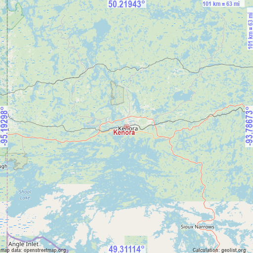
Kenora GPS coordinates[2]
49° 46' 2.676" North, 94° 29' 23.46" West
| Map corner | latitude | longitude |
|---|---|---|
| Upper-left | 50.21943°, | -95.19298° |
| Center: | 49.76741°, | -94.48985° |
| Lower-right: | 49.31114°, | -93.78673° |
| Map W x H: | 101×101 km | = 62.8×62.8mi |
| max Lat: | 73.03752° ⇑26.4% North |
| Kenora: | 49.76741° |
| min Lat: | ⇓73.6% South 42.05009° |
| min Long | Kenora | max Long |
| -139.43328° | -94.48985° | -52.70931° |
| W 34.9%⇐ | ⇒65.1% E |
Elevation
Elevation of Kenora is 328 m = 1076 ft, and this is 73.6 m = 241 ft above average elevation for this country.
| Max E: |
1518 m = 4980 ft | 28% |
| Kenora | 328 m 1076 ft | |
| Avg. | 254.4 m = 835 ft | |
Min E: |
-2 m = -7 ft | 72% |
See also: Canada elevation on elevation.city.
Geographical zone
Kenora is located in North temperate zone (between Tropic of Cancer and the Arctic Circle). Distance of this North polar circle is 1867.6 km =1160.5 mi to North.| Distance of | km | miles | from Kenora |
|---|---|---|---|
| North Pole | 4473.4 | 2779.6 | to North |
| Arctic Circle | 1867.6 | 1160.5 | to North |
| Tropic Cancer | 2927.7 | 1819.2 | to South |
| Equator | 5533.6 | 3438.4 | to South |


Nearby cities:
15 places around Kenora: (largest is in red/bold)
• Beausejour
148.8 km =92.5 mi,  282°
282°
• Dryden
124.9 km =77.6 mi,  89°
89°
• Ear Falls
131.8 km =81.9 mi,  42°
42°
• Fort Frances
150.5 km =93.5 mi,  148°
148°
• Garson
162.4 km =100.9 mi, 282°
• Golden
153.2 km =95.2 mi,  20°
20°
• La Broquerie
147.4 km =91.6 mi,  259°
259°
• Lac du Bonnet
124.6 km =77.4 mi,  295°
295°
• Moose Lake
85.9 km =53.4 mi,  223°
223°
• Pine Falls
151.8 km =94.3 mi,  305°
305°
• Powerview
150.7 km =93.6 mi, 306°
• Red Lake
146.6 km =91.1 mi, 18°
• Red Lake
154.1 km =95.8 mi, 20°
• Steinbach
160.3 km =99.6 mi, 260°
• Tyndall
159.2 km =98.9 mi, 282°
Sources, notices
• [Note1] Compared only with cities in Canada existing in our database
• [Src1] Map data: © OpenStreetMap contributors (CC-BY-SA)
• [Src2] Other city data from geonames.org with taken over terms of usage.
• [Src3] Geographical zone / Annual Mean Temperature by Robert A. Rohde @ Wikipedia
