Vegreville geodata
Vegreville (Alberta) is a populated place; located in Canada in America/Edmonton (GMT-6) time zone. With population of 5,678 people, there are 442 cities with bigger population in this country. Compared to other cities in Canada, 91.5% of cities are located further ↓South; 76.6% of cities are located further →East and 88.5% of cities have lower elevation than Vegreville. Note1


Vegreville GPS coordinates[2]
53° 30' 0.54" North, 112° 3' 6.552" West
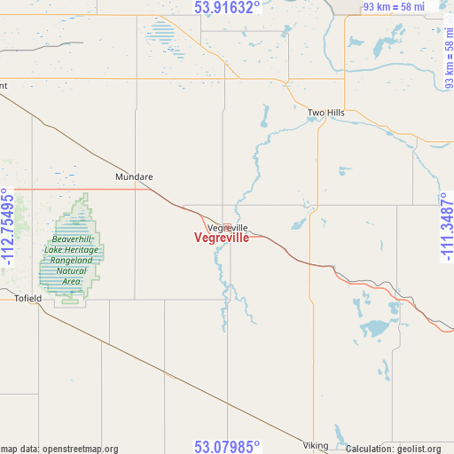
| Map corner | latitude | longitude |
|---|---|---|
| Upper-left | 53.91632°, | -112.75495° |
| Center: | 53.50015°, | -112.05182° |
| Lower-right: | 53.07985°, | -111.3487° |
| Map W x H: | 93×93 km | = 57.8×57.8mi |
| max Lat: | 73.03752° ⇑8.5% North |
| Vegreville: | 53.50015° |
| min Lat: | ⇓91.5% South 42.05009° |
| min Long | Vegreville | max Long |
| -139.43328° | -112.05182° | -52.70931° |
| W 23.4%⇐ | ⇒76.6% E |
Elevation
Elevation of Vegreville is 635 m = 2083 ft, and this is 380.6 m = 1249 ft above average elevation for this country.
| Max E: |
1518 m = 4980 ft | 11.5% |
| Vegreville | 635 m 2083 ft | |
| Avg. | 254.4 m = 835 ft | |
Min E: |
-2 m = -7 ft | 88.5% |
See also: Canada elevation on elevation.city.
Geographical zone
Vegreville is located in North temperate zone (between Tropic of Cancer and the Arctic Circle). Distance of this North polar circle is 1452.5 km =902.5 mi to North.| Distance of | km | miles | from Vegreville |
|---|---|---|---|
| North Pole | 4058.4 | 2521.8 | to North |
| Arctic Circle | 1452.5 | 902.5 | to North |
| Tropic Cancer | 3342.7 | 2077.1 | to South |
| Equator | 5948.7 | 3696.3 | to South |


Nearby cities:
15 places around Vegreville: (largest is in red/bold)
• Camrose
74.9 km =46.5 mi,  224°
224°
• Elk Point
87.8 km =54.6 mi,  59°
59°
• Fort Saskatchewan
80.7 km =50.1 mi,  287°
287°
• Killam
80.8 km =50.2 mi,  170°
170°
• Lamont
57.7 km =35.9 mi,  300°
300°
• Mannville
61.4 km =38.2 mi,  107°
107°
• Maple Ridge
86.7 km =53.9 mi,  270°
270°
• Sherwood Park
83.8 km =52.1 mi, 271°
• Smoky Lake
73.8 km =45.9 mi,  338°
338°
• St. Paul
73.7 km =45.8 mi,  43°
43°
• Tamarack
86.8 km =53.9 mi, 267°
• Tofield
43.5 km =27 mi,  250°
250°
• Two Hills
31.2 km =19.4 mi, 39°
• Vermilion
80.7 km =50.1 mi,  101°
101°
• Viking
48.3 km =30 mi,  157°
157°
Sources, notices
• [Note1] Compared only with cities in Canada existing in our database
• [Src1] Map data: © OpenStreetMap contributors (CC-BY-SA)
• [Src2] Other city data from geonames.org with taken over terms of usage.
• [Src3] Geographical zone / Annual Mean Temperature by Robert A. Rohde @ Wikipedia
