Watrous geodata
Watrous (Saskatchewan) is a populated place; located in Canada in America/Regina (GMT-6) time zone. With population of 1,865 people, there are 777 cities with bigger population in this country. Compared to other cities in Canada, 84.9% of cities are located further ↓South; 72.4% of cities are located further →East and 83.9% of cities have lower elevation than Watrous. Note1


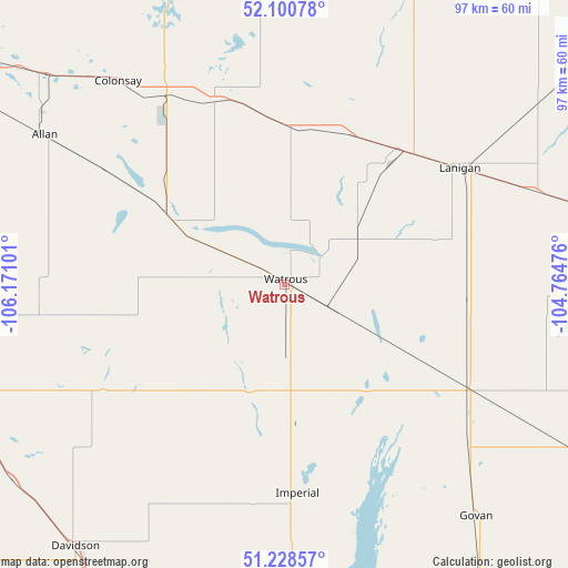
Watrous GPS coordinates[2]
51° 40' 0.372" North, 105° 28' 4.368" West
| Map corner | latitude | longitude |
|---|---|---|
| Upper-left | 52.10078°, | -106.17101° |
| Center: | 51.66677°, | -105.46788° |
| Lower-right: | 51.22857°, | -104.76476° |
| Map W x H: | 97×97 km | = 60.3×60.3mi |
| max Lat: | 73.03752° ⇑15.1% North |
| Watrous: | 51.66677° |
| min Lat: | ⇓84.9% South 42.05009° |
| min Long | Watrous | max Long |
| -139.43328° | -105.46788° | -52.70931° |
| W 27.6%⇐ | ⇒72.4% E |
Elevation
Elevation of Watrous is 543 m = 1781 ft, and this is 288.6 m = 947 ft above average elevation for this country.
| Max E: |
1518 m = 4980 ft | 16.1% |
| Watrous | 543 m 1781 ft | |
| Avg. | 254.4 m = 835 ft | |
Min E: |
-2 m = -7 ft | 83.9% |
See also: Canada elevation on elevation.city.
Geographical zone
Watrous is located in North temperate zone (between Tropic of Cancer and the Arctic Circle). Distance of this North polar circle is 1656.4 km =1029.2 mi to North.| Distance of | km | miles | from Watrous |
|---|---|---|---|
| North Pole | 4262.3 | 2648.5 | to North |
| Arctic Circle | 1656.4 | 1029.2 | to North |
| Tropic Cancer | 3138.9 | 1950.4 | to South |
| Equator | 5744.8 | 3569.7 | to South |


Nearby cities:
15 places around Watrous: (largest is in red/bold)
• Dalmeny
115.8 km =72 mi,  309°
309°
• Davidson
57.1 km =35.5 mi,  218°
218°
• Foam Lake
133.4 km =82.9 mi,  90°
90°
• Humboldt
63.8 km =39.6 mi,  21°
21°
• Langham
128.8 km =80 mi, 307°
• Lanigan
36.1 km =22.4 mi,  55°
55°
• Lumsden
120.5 km =74.9 mi,  159°
159°
• Martensville
107 km =66.5 mi, 309°
• Outlook
111 km =69 mi,  260°
260°
• Regina Beach
103.5 km =64.3 mi, 161°
• Rosthern
125.9 km =78.2 mi,  332°
332°
• Saskatoon
97.3 km =60.5 mi,  302°
302°
• Wadena
118.8 km =73.8 mi,  74°
74°
• Warman
104.4 km =64.9 mi, 313°
• Wynyard
89.1 km =55.4 mi,  82°
82°
Sources, notices
• [Note1] Compared only with cities in Canada existing in our database
• [Src1] Map data: © OpenStreetMap contributors (CC-BY-SA)
• [Src2] Other city data from geonames.org with taken over terms of usage.
• [Src3] Geographical zone / Annual Mean Temperature by Robert A. Rohde @ Wikipedia
