Bathurst geodata
Bathurst (New Brunswick) is a populated place; located in Canada in America/Moncton (GMT-3) time zone. With population of 12,714 people, there are 266 cities with bigger population in this country. Compared to other cities in Canada, 51.9% of cities are located further ↓South; 89% of cities are located further ←West and 96.5% of cities have higher elevation than Bathurst. Note1


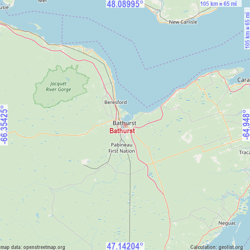
Bathurst GPS coordinates[2]
47° 37' 5.304" North, 65° 39' 4.032" West
| Map corner | latitude | longitude |
|---|---|---|
| Upper-left | 48.08995°, | -66.35425° |
| Center: | 47.61814°, | -65.65112° |
| Lower-right: | 47.14204°, | -64.948° |
| Map W x H: | 105.4×105.4 km | = 65.5×65.5mi |
| max Lat: | 73.03752° ⇑48.1% North |
| Bathurst: | 47.61814° |
| min Lat: | ⇓51.9% South 42.05009° |
| min Long | Bathurst | max Long |
| -139.43328° | -65.65112° | -52.70931° |
| W 89%⇐ | ⇒11% E |
Elevation
Elevation of Bathurst is 6 m = 20 ft, and this is 248.4 m = 815 ft below average elevation for this country.
| Max E: |
1518 m = 4980 ft | 96.5% |
| Avg. | 254.4 m = 835 ft | |
| Bathurst | 6 m = 20 ft | |
Min E: |
-2 m = -7 ft | 3.5% |
See also: Canada elevation on elevation.city.
Geographical zone
Bathurst is located in North temperate zone (between Tropic of Cancer and the Arctic Circle). Distance of this North polar circle is 2106.5 km =1308.9 mi to North.| Distance of | km | miles | from Bathurst |
|---|---|---|---|
| North Pole | 4712.4 | 2928.1 | to North |
| Arctic Circle | 2106.5 | 1308.9 | to North |
| Tropic Cancer | 2688.7 | 1670.7 | to South |
| Equator | 5294.6 | 3289.9 | to South |


Nearby cities:
15 places around Bathurst: (largest is in red/bold)
• Bonaventure
49 km =30.4 mi,  13°
13°
• Dunlop
9.9 km =6.2 mi,  321°
321°
• Fair Isle
54.7 km =34 mi,  133°
133°
• Leech
53.5 km =33.2 mi,  110°
110°
• Lorne
45.5 km =28.3 mi,  308°
308°
• Maisonnette
53.9 km =33.5 mi,  64°
64°
• New Carlisle
49.5 km =30.8 mi,  28°
28°
• Nicholas Denys
19.4 km =12.1 mi,  297°
297°
• North Tetagouche
8.3 km =5.2 mi,  283°
283°
• Petit-Rocher-Nord
22.1 km =13.7 mi,  344°
344°
• Robertville
12.6 km =7.8 mi, 313°
• Saint Irénée and Alderwood
51.6 km =32.1 mi,  104°
104°
• Saint-Sauveur
30.3 km =18.8 mi, 108°
• Saumarez
55 km =34.2 mi, 103°
• Tracadie-Sheila
56.2 km =34.9 mi, 101°
Sources, notices
• [Note1] Compared only with cities in Canada existing in our database
• [Src1] Map data: © OpenStreetMap contributors (CC-BY-SA)
• [Src2] Other city data from geonames.org with taken over terms of usage.
• [Src3] Geographical zone / Annual Mean Temperature by Robert A. Rohde @ Wikipedia
