Maisonnette geodata
Maisonnette (New Brunswick) is a populated place; located in Canada in America/Moncton (GMT-3) time zone. With population of 605 people, there are 1147 cities with bigger population in this country. Compared to other cities in Canada, 53.5% of cities are located further ↓South; 90.2% of cities are located further ←West and 98.5% of cities have higher elevation than Maisonnette. Note1


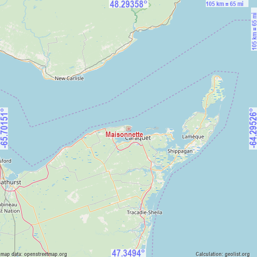
Maisonnette GPS coordinates[2]
47° 49' 25.104" North, 64° 59' 54.168" West
| Map corner | latitude | longitude |
|---|---|---|
| Upper-left | 48.29358°, | -65.70151° |
| Center: | 47.82364°, | -64.99838° |
| Lower-right: | 47.3494°, | -64.29526° |
| Map W x H: | 105×105 km | = 65.2×65.2mi |
| max Lat: | 73.03752° ⇑46.5% North |
| Maisonnette: | 47.82364° |
| min Lat: | ⇓53.5% South 42.05009° |
| min Long | Maisonnette | max Long |
| -139.43328° | -64.99838° | -52.70931° |
| W 90.2%⇐ | ⇒9.8% E |
Elevation
Elevation of Maisonnette is 2 m = 7 ft, and this is 252.4 m = 828 ft below average elevation for this country.
| Max E: |
1518 m = 4980 ft | 98.5% |
| Avg. | 254.4 m = 835 ft | |
| Maisonnette | 2 m = 7 ft | |
Min E: |
-2 m = -7 ft | 1.5% |
See also: Canada elevation on elevation.city.
Geographical zone
Maisonnette is located in North temperate zone (between Tropic of Cancer and the Arctic Circle). Distance of this North polar circle is 2083.7 km =1294.8 mi to North.| Distance of | km | miles | from Maisonnette |
|---|---|---|---|
| North Pole | 4689.6 | 2914 | to North |
| Arctic Circle | 2083.7 | 1294.8 | to North |
| Tropic Cancer | 2711.6 | 1684.9 | to South |
| Equator | 5317.5 | 3304.1 | to South |


Nearby cities:
15 places around Maisonnette: (largest is in red/bold)
• Bathurst
53.9 km =33.5 mi,  244°
244°
• Bonaventure
44.3 km =27.5 mi,  303°
303°
• Brantville
50.6 km =31.4 mi,  177°
177°
• Haut-Sheila
10.8 km =6.7 mi,  142°
142°
• Leech
41.2 km =25.6 mi, 178°
• Miscou
34.6 km =21.5 mi,  67°
67°
• New Carlisle
32.6 km =20.3 mi,  309°
309°
• Petit-Rocher-Nord
54.8 km =34.1 mi,  268°
268°
• Saint Irénée and Alderwood
36.1 km =22.4 mi, 178°
• Saint-Sauveur
38.5 km =23.9 mi,  211°
211°
• Saint-Simon
15.2 km =9.4 mi,  129°
129°
• Sainte-Cécile
25.1 km =15.6 mi,  82°
82°
• Saumarez
36.2 km =22.5 mi,  172°
172°
• Shippagan
23.4 km =14.5 mi,  112°
112°
• Tracadie-Sheila
34.9 km =21.7 mi, 170°
Sources, notices
• [Note1] Compared only with cities in Canada existing in our database
• [Src1] Map data: © OpenStreetMap contributors (CC-BY-SA)
• [Src2] Other city data from geonames.org with taken over terms of usage.
• [Src3] Geographical zone / Annual Mean Temperature by Robert A. Rohde @ Wikipedia
