Bonaventure geodata
Bonaventure (Quebec) is a populated place; located in Canada in America/Toronto (GMT-4) time zone. With population of 2,673 people, there are 653 cities with bigger population in this country. Compared to other cities in Canada, 54.5% of cities are located further ↓South; 89.3% of cities are located further ←West and 98.1% of cities have higher elevation than Bonaventure. Note1
Administrative division(s):
- Level 1: Quebec
- Level 2: Gaspésie-Îles-de-la-Madeleine
- Level 3: Bonaventure


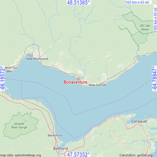
Bonaventure GPS coordinates[2]
48° 2' 44.628" North, 65° 29' 33.324" West
| Map corner | latitude | longitude |
|---|---|---|
| Upper-left | 48.51365°, | -66.19572° |
| Center: | 48.04573°, | -65.49259° |
| Lower-right: | 47.57352°, | -64.78947° |
| Map W x H: | 104.5×104.5 km | = 64.9×64.9mi |
| max Lat: | 73.03752° ⇑45.5% North |
| Bonaventure: | 48.04573° |
| min Lat: | ⇓54.5% South 42.05009° |
| min Long | Bonaventure | max Long |
| -139.43328° | -65.49259° | -52.70931° |
| W 89.3%⇐ | ⇒10.7% E |
Elevation
Elevation of Bonaventure is 3 m = 10 ft, and this is 251.4 m = 825 ft below average elevation for this country.
| Max E: |
1518 m = 4980 ft | 98.1% |
| Avg. | 254.4 m = 835 ft | |
| Bonaventure | 3 m = 10 ft | |
Min E: |
-2 m = -7 ft | 1.9% |
See also: Canada elevation on elevation.city.
Geographical zone
Bonaventure is located in North temperate zone (between Tropic of Cancer and the Arctic Circle). Distance of this North polar circle is 2059 km =1279.4 mi to North.| Distance of | km | miles | from Bonaventure |
|---|---|---|---|
| North Pole | 4664.9 | 2898.6 | to North |
| Arctic Circle | 2059 | 1279.4 | to North |
| Tropic Cancer | 2736.3 | 1700.3 | to South |
| Equator | 5342.2 | 3319.5 | to South |


Nearby cities:
15 places around Bonaventure: (largest is in red/bold)
• Bathurst
49 km =30.4 mi,  193°
193°
• Carleton
45.5 km =28.3 mi,  277°
277°
• Carleton-sur-Mer
47.7 km =29.6 mi, 278°
• Dunlop
43.7 km =27.2 mi,  204°
204°
• Haut-Sheila
54.6 km =33.9 mi,  127°
127°
• Lorne
50.9 km =31.6 mi,  247°
247°
• Maisonnette
44.3 km =27.5 mi,  123°
123°
• Maria
39.3 km =24.4 mi,  291°
291°
• New Carlisle
12.3 km =7.6 mi,  109°
109°
• New-Richmond
30 km =18.6 mi,  295°
295°
• Nicholas Denys
48.2 km =30 mi,  216°
216°
• North Tetagouche
49.8 km =30.9 mi, 203°
• Petit-Rocher-Nord
31.8 km =19.8 mi,  214°
214°
• Robertville
44.1 km =27.4 mi, 208°
• Saint-Simon
59.5 km =37 mi, 125°
Sources, notices
• [Note1] Compared only with cities in Canada existing in our database
• [Src1] Map data: © OpenStreetMap contributors (CC-BY-SA)
• [Src2] Other city data from geonames.org with taken over terms of usage.
• [Src3] Geographical zone / Annual Mean Temperature by Robert A. Rohde @ Wikipedia
