Weymontachie geodata
Weymontachie (Quebec) is a populated place; located in Canada in America/Toronto (GMT-4) time zone. With population of 1,038 people, there are 1028 cities with bigger population in this country. Compared to other cities in Canada, 53.9% of cities are located further ↓South; 65% of cities are located further ←West and 74.3% of cities have lower elevation than Weymontachie. Note1


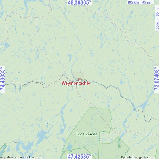
Weymontachie GPS coordinates[2]
47° 53' 57.84" North, 73° 46' 37.92" West
| Map corner | latitude | longitude |
|---|---|---|
| Upper-left | 48.36865°, | -74.48033° |
| Center: | 47.8994°, | -73.7772° |
| Lower-right: | 47.42585°, | -73.07408° |
| Map W x H: | 104.8×104.8 km | = 65.1×65.1mi |
| max Lat: | 73.03752° ⇑46.1% North |
| Weymontachie: | 47.8994° |
| min Lat: | ⇓53.9% South 42.05009° |
| min Long | Weymontachie | max Long |
| -139.43328° | -73.7772° | -52.70931° |
| W 65%⇐ | ⇒35% E |
Elevation
Elevation of Weymontachie is 351 m = 1152 ft, and this is 96.6 m = 317 ft above average elevation for this country.
| Max E: |
1518 m = 4980 ft | 25.7% |
| Weymontachie | 351 m 1152 ft | |
| Avg. | 254.4 m = 835 ft | |
Min E: |
-2 m = -7 ft | 74.3% |
See also: Canada elevation on elevation.city.
Geographical zone
Weymontachie is located in North temperate zone (between Tropic of Cancer and the Arctic Circle). Distance of this North polar circle is 2075.3 km =1289.5 mi to North.| Distance of | km | miles | from Weymontachie |
|---|---|---|---|
| North Pole | 4681.1 | 2908.7 | to North |
| Arctic Circle | 2075.3 | 1289.5 | to North |
| Tropic Cancer | 2720 | 1690.1 | to South |
| Equator | 5325.9 | 3309.4 | to South |


Nearby cities:
15 places around Weymontachie: (largest is in red/bold)
• Albanel
146.9 km =91.3 mi,  41°
41°
• Chambord
140.1 km =87.1 mi,  64°
64°
• Dolbeau-Mistassini
157.7 km =98 mi,  46°
46°
• La Tuque
90.7 km =56.4 mi,  124°
124°
• Laurentides
140.9 km =87.6 mi,  127°
127°
• Leblanc
58.9 km =36.6 mi,  313°
313°
• Manawan
88.3 km =54.9 mi,  211°
211°
• Metabetchouan-Lac-a-la-Croix
158.6 km =98.5 mi,  69°
69°
• Métabetchouan
140.7 km =87.4 mi, 68°
• Normandin
138.7 km =86.2 mi, 41°
• Roberval
133.5 km =83 mi, 59°
• Saint-Félicien
128.9 km =80.1 mi, 49°
• Saint-Michel-des-Saints
136.3 km =84.7 mi,  184°
184°
• Saint-Prime
131.3 km =81.6 mi, 54°
• Sainte-Thècle
154.1 km =95.8 mi,  141°
141°
Sources, notices
• [Note1] Compared only with cities in Canada existing in our database
• [Src1] Map data: © OpenStreetMap contributors (CC-BY-SA)
• [Src2] Other city data from geonames.org with taken over terms of usage.
• [Src3] Geographical zone / Annual Mean Temperature by Robert A. Rohde @ Wikipedia
