New-Richmond geodata
New-Richmond (Quebec) is a populated place; located in Canada in America/Toronto (GMT-4) time zone. With population of 3,748 people, there are 551 cities with bigger population in this country. Compared to other cities in Canada, 55.1% of cities are located further ↓South; 88.2% of cities are located further ←West and 96% of cities have higher elevation than New-Richmond. Note1
Administrative division(s):
- Level 1: Quebec
- Level 2: Gaspésie-Îles-de-la-Madeleine
- Level 3: New Richmond


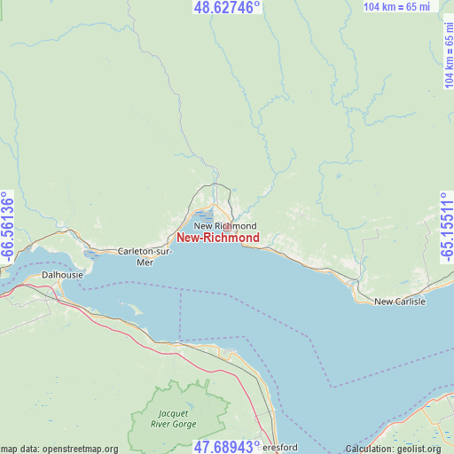
New-Richmond GPS coordinates[2]
48° 9' 38.124" North, 65° 51' 29.628" West
| Map corner | latitude | longitude |
|---|---|---|
| Upper-left | 48.62746°, | -66.56136° |
| Center: | 48.16059°, | -65.85823° |
| Lower-right: | 47.68943°, | -65.15511° |
| Map W x H: | 104.3×104.3 km | = 64.8×64.8mi |
| max Lat: | 73.03752° ⇑44.9% North |
| New-Richmond: | 48.16059° |
| min Lat: | ⇓55.1% South 42.05009° |
| min Long | New-Richmond | max Long |
| -139.43328° | -65.85823° | -52.70931° |
| W 88.2%⇐ | ⇒11.8% E |
Elevation
Elevation of New-Richmond is 7 m = 23 ft, and this is 247.4 m = 812 ft below average elevation for this country.
| Max E: |
1518 m = 4980 ft | 96% |
| Avg. | 254.4 m = 835 ft | |
| New-Richmond | 7 m = 23 ft | |
Min E: |
-2 m = -7 ft | 4% |
See also: Canada elevation on elevation.city.
Geographical zone
New-Richmond is located in North temperate zone (between Tropic of Cancer and the Arctic Circle). Distance of this North polar circle is 2046.2 km =1271.4 mi to North.| Distance of | km | miles | from New-Richmond |
|---|---|---|---|
| North Pole | 4652.1 | 2890.7 | to North |
| Arctic Circle | 2046.2 | 1271.4 | to North |
| Tropic Cancer | 2749 | 1708.1 | to South |
| Equator | 5355 | 3327.4 | to South |


Nearby cities:
15 places around New-Richmond: (largest is in red/bold)
• Bathurst
62.3 km =38.7 mi,  165°
165°
• Bonaventure
30 km =18.6 mi,  115°
115°
• Campbellton
62.8 km =39 mi,  254°
254°
• Carleton
19.3 km =12 mi, 248°
• Carleton-sur-Mer
20.9 km =13 mi, 253°
• Dunlop
53.5 km =33.2 mi, 170°
• Lorne
37.6 km =23.4 mi,  212°
212°
• Maisonnette
74.1 km =46 mi, 120°
• Maria
9.6 km =6 mi,  279°
279°
• New Carlisle
42.3 km =26.3 mi,  113°
113°
• Nicholas Denys
51.4 km =31.9 mi,  181°
181°
• North Tetagouche
58.9 km =36.6 mi, 172°
• Petit-Rocher-Nord
40.2 km =25 mi, 166°
• Robertville
52 km =32.3 mi, 173°
• Saint-Sauveur
82.8 km =51.4 mi,  147°
147°
Sources, notices
• [Note1] Compared only with cities in Canada existing in our database
• [Src1] Map data: © OpenStreetMap contributors (CC-BY-SA)
• [Src2] Other city data from geonames.org with taken over terms of usage.
• [Src3] Geographical zone / Annual Mean Temperature by Robert A. Rohde @ Wikipedia
