Englishman River South geodata
Englishman River South (British Columbia) is a populated place; located in Canada in America/Vancouver (GMT-7) time zone. With population of 748 people, there are 1112 cities with bigger population in this country. Compared to other cities in Canada, 67.7% of cities are located further ↓South; 96.9% of cities are located further →East and 68.2% of cities have higher elevation than Englishman River South. Note1


Englishman River South GPS coordinates[2]
49° 16' 55.524" North, 124° 16' 53.904" West
| Map corner | latitude | longitude |
|---|---|---|
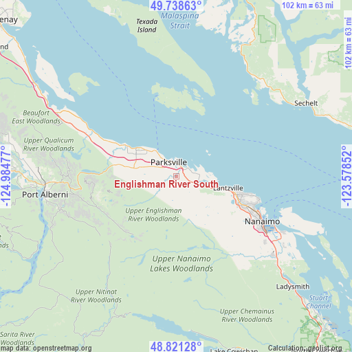
| Upper-left | 49.73863°, | -124.98477° |
| Center: | 49.28209°, | -124.28164° |
| Lower-right: | 48.82128°, | -123.57852° |
| Map W x H: | 102×102 km | = 63.4×63.4mi |
| max Lat: | 73.03752° ⇑32.3% North |
| Englishman River South: | 49.28209° |
| min Lat: | ⇓67.7% South 42.05009° |
| min Long | Englishman Rive | max Long |
| -139.43328° | -124.28164° | -52.70931° |
| W 3.1%⇐ | ⇒96.9% E |
Elevation
Elevation of Englishman River South is 62 m = 203 ft, and this is 192.4 m = 631 ft below average elevation for this country.
| Max E: |
1518 m = 4980 ft | 68.2% |
| Avg. | 254.4 m = 835 ft | |
| Englishman River South | 62 m = 203 ft | |
Min E: |
-2 m = -7 ft | 31.8% |
See also: Canada elevation on elevation.city.
Geographical zone
Englishman River South is located in North temperate zone (between Tropic of Cancer and the Arctic Circle). Distance of this North polar circle is 1921.5 km =1194 mi to North.| Distance of | km | miles | from Englishman River South |
|---|---|---|---|
| North Pole | 4527.4 | 2813.2 | to North |
| Arctic Circle | 1921.5 | 1194 | to North |
| Tropic Cancer | 2873.7 | 1785.6 | to South |
| Equator | 5479.7 | 3404.9 | to South |


Nearby cities:
15 places around Englishman River South: (largest is in red/bold)
• Cassidy
38.7 km =24 mi,  131°
131°
• Cedar
36.2 km =22.5 mi,  120°
120°
• Coombs
10.2 km =6.3 mi,  281°
281°
• Dashwood
19.6 km =12.2 mi,  298°
298°
• East Wellington
22.6 km =14 mi, 122°
• Fairwinds
11.2 km =7 mi,  93°
93°
• French Creek
8.5 km =5.3 mi,  320°
320°
• Hornby Island
39.7 km =24.7 mi, 315°
• Nanaimo
27.9 km =17.3 mi, 117°
• North Oyster/Yellow Point
41.7 km =25.9 mi, 128°
• Parksville
4.8 km =3 mi,  329°
329°
• Port Alberni
38.1 km =23.7 mi,  263°
263°
• Sechelt
43.5 km =27 mi,  60°
60°
• South Pender Harbour
42.1 km =26.2 mi,  26°
26°
• Welcome Beach
35.7 km =22.2 mi,  52°
52°
Sources, notices
• [Note1] Compared only with cities in Canada existing in our database
• [Src1] Map data: © OpenStreetMap contributors (CC-BY-SA)
• [Src2] Other city data from geonames.org with taken over terms of usage.
• [Src3] Geographical zone / Annual Mean Temperature by Robert A. Rohde @ Wikipedia
