Welcome Beach geodata
Welcome Beach (British Columbia) is a populated locality; located in Canada in America/Vancouver (GMT-7) time zone. With population of 1,125 people, there are 986 cities with bigger population in this country. Compared to other cities in Canada, 69.9% of cities are located further ↓South; 96.2% of cities are located further →East and 64.1% of cities have higher elevation than Welcome Beach. Note1


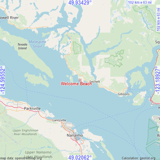
Welcome Beach GPS coordinates[2]
49° 28' 46.524" North, 123° 53' 32.604" West
| Map corner | latitude | longitude |
|---|---|---|
| Upper-left | 49.93429°, | -124.59552° |
| Center: | 49.47959°, | -123.89239° |
| Lower-right: | 49.02062°, | -123.18927° |
| Map W x H: | 101.6×101.6 km | = 63.1×63.1mi |
| max Lat: | 73.03752° ⇑30.1% North |
| Welcome Beach: | 49.47959° |
| min Lat: | ⇓69.9% South 42.05009° |
| min Long | Welcome Beach | max Long |
| -139.43328° | -123.89239° | -52.70931° |
| W 3.8%⇐ | ⇒96.2% E |
Elevation
Elevation of Welcome Beach is 81 m = 266 ft, and this is 173.4 m = 569 ft below average elevation for this country.
| Max E: |
1518 m = 4980 ft | 64.1% |
| Avg. | 254.4 m = 835 ft | |
| Welcome Beach | 81 m = 266 ft | |
Min E: |
-2 m = -7 ft | 35.9% |
See also: Canada elevation on elevation.city.
Geographical zone
Welcome Beach is located in North temperate zone (between Tropic of Cancer and the Arctic Circle). Distance of this North polar circle is 1899.6 km =1180.4 mi to North.| Distance of | km | miles | from Welcome Beach |
|---|---|---|---|
| North Pole | 4505.4 | 2799.5 | to North |
| Arctic Circle | 1899.6 | 1180.4 | to North |
| Tropic Cancer | 2895.7 | 1799.3 | to South |
| Equator | 5501.6 | 3418.5 | to South |


Nearby cities:
15 places around Welcome Beach: (largest is in red/bold)
• Bowen Island
41.6 km =25.8 mi,  104°
104°
• Cassidy
47.8 km =29.7 mi,  179°
179°
• Cedar
40.5 km =25.2 mi, 175°
• Coombs
43.1 km =26.8 mi,  242°
242°
• Dashwood
47.1 km =29.3 mi,  254°
254°
• East Wellington
35.2 km =21.9 mi,  194°
194°
• Englishman River South
35.7 km =22.2 mi,  232°
232°
• Fairwinds
28.3 km =17.6 mi,  216°
216°
• French Creek
36.9 km =22.9 mi, 245°
• Gibsons
29.5 km =18.3 mi,  108°
108°
• Lions Bay
47.4 km =29.5 mi,  93°
93°
• Nanaimo
35 km =21.7 mi, 185°
• Parksville
35.4 km =22 mi, 239°
• Sechelt
9.6 km =6 mi, 92°
• South Pender Harbour
18.5 km =11.5 mi,  328°
328°
Sources, notices
• [Note1] Compared only with cities in Canada existing in our database
• [Src1] Map data: © OpenStreetMap contributors (CC-BY-SA)
• [Src2] Other city data from geonames.org with taken over terms of usage.
• [Src3] Geographical zone / Annual Mean Temperature by Robert A. Rohde @ Wikipedia
