Lubumbashi geodata
Lubumbashi (Haut-Katanga) is a seat of a first-order administrative division; located in Democratic Republic of the Congo in Africa/Lubumbashi (GMT+2) time zone. With population of 1,373,770 people, there is 1 city with bigger population in this country. Compared to other cities in Democratic Republic of the Congo, 98.6% of cities are located further ↑North; 82.9% of cities are located further ←West and 85.7% of cities have lower elevation than Lubumbashi. Note1


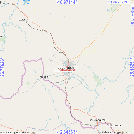
Lubumbashi GPS coordinates[2]
11° 39' 39.204" South, 27° 28' 45.768" East
| Map corner | latitude | longitude |
|---|---|---|
| Upper-left | -10.97144°, | 26.77626° |
| Center: | -11.66089°, | 27.47938° |
| Lower-right: | -12.34863°, | 28.18251° |
| Map W x H: | 153.1×153.1 km | = 95.1×95.1mi |
| max Lat: | 4.279° ⇑98.6% North |
| Lubumbashi: | -11.66089° |
| min Lat: | ⇓1.4% South -11.76097° |
| min Long | Lubumbashi | max Long |
| 12.37148° | 27.47938° | 30.25224° |
| W 82.9%⇐ | ⇒17.1% E |
Elevation
Elevation of Lubumbashi is 1260 m = 4134 ft, and this is 604 m = 1982 ft above average elevation for this country.
| Max E: |
1996 m = 6549 ft | 14.3% |
| Lubumbashi | 1260 m 4134 ft | |
| Avg. | 656 m = 2152 ft | |
Min E: |
11 m = 36 ft | 85.7% |
See also: Lubumbashi elevation on elevation.city.
Geographical zone
Lubumbashi is located in South Torrid zone (between Equator and Tropic of Capricorn). Distance of Equator is 1296.6 km =805.7 mi to North.| Distance of | km | miles | from Lubumbashi |
|---|---|---|---|
| Equator | 1296.6 | 805.7 | to North |
| Tropic Capricorn | 1309.3 | 813.6 | to South |
| Antarctic Circle | 6104.6 | 3793.2 | to South |
| South Pole | 8710.5 | 5412.5 | to South |


Nearby cities:
6 places around Lubumbashi: (largest is in red/bold)
• Bukama
325.8 km =202.4 mi,  326°
326°
• Kambove
130.1 km =80.8 mi,  312°
312°
• Kamina
423.7 km =263.3 mi,  320°
320°
• Kipushi
27.2 km =16.9 mi,  245°
245°
• Kolwezi
243.4 km =151.2 mi,  295°
295°
• Likasi
110.5 km =68.7 mi, 313°
Sources, notices
• [Note1] Compared only with cities in Democratic Republic of the Congo existing in our database
• [Src1] Map data: © OpenStreetMap contributors (CC-BY-SA)
• [Src2] Other city data from geonames.org with taken over terms of usage.
• [Src3] Geographical zone / Annual Mean Temperature by Robert A. Rohde @ Wikipedia
