Kolwezi geodata
Kolwezi (Lualaba) is a seat of a second-order administrative division; located in Democratic Republic of the Congo in Africa/Lubumbashi (GMT+2) time zone. With population of 418,000 people, there are 7 cities with bigger population in this country. Compared to other cities in Democratic Republic of the Congo, 94.3% of cities are located further ↑North; 67.1% of cities are located further ←West and 94.3% of cities have lower elevation than Kolwezi. Note1


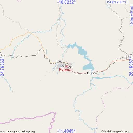
Kolwezi GPS coordinates[2]
10° 42' 53.424" South, 25° 28' 0.264" East
| Map corner | latitude | longitude |
|---|---|---|
| Upper-left | -10.0232°, | 24.76362° |
| Center: | -10.71484°, | 25.46674° |
| Lower-right: | -11.4049°, | 26.16987° |
| Map W x H: | 153.6×153.6 km | = 95.4×95.4mi |
| max Lat: | 4.279° ⇑94.3% North |
| Kolwezi: | -10.71484° |
| min Lat: | ⇓5.7% South -11.76097° |
| min Long | Kolwezi | max Long |
| 12.37148° | 25.46674° | 30.25224° |
| W 67.1%⇐ | ⇒32.9% E |
Elevation
Elevation of Kolwezi is 1485 m = 4872 ft, and this is 829 m = 2720 ft above average elevation for this country.
| Max E: |
1996 m = 6549 ft | 5.7% |
| Kolwezi | 1485 m 4872 ft | |
| Avg. | 656 m = 2152 ft | |
Min E: |
11 m = 36 ft | 94.3% |
See also: Kolwezi elevation on elevation.city.
Geographical zone
Kolwezi is located in South Torrid zone (between Equator and Tropic of Capricorn). Distance of Equator is 1191.4 km =740.3 mi to North.| Distance of | km | miles | from Kolwezi |
|---|---|---|---|
| Equator | 1191.4 | 740.3 | to North |
| Tropic Capricorn | 1414.5 | 878.9 | to South |
| Antarctic Circle | 6209.8 | 3858.6 | to South |
| South Pole | 8815.7 | 5477.8 | to South |


Nearby cities:
6 places around Kolwezi: (largest is in red/bold)
• Bukama
173.2 km =107.6 mi,  14°
14°
• Kambove
124.8 km =77.5 mi,  98°
98°
• Kamina
226 km =140.4 mi,  346°
346°
• Kipushi
226.7 km =140.9 mi,  120°
120°
• Likasi
142 km =88.2 mi, 102°
• Lubumbashi
243.4 km =151.2 mi, 115°
Sources, notices
• [Note1] Compared only with cities in Democratic Republic of the Congo existing in our database
• [Src1] Map data: © OpenStreetMap contributors (CC-BY-SA)
• [Src2] Other city data from geonames.org with taken over terms of usage.
• [Src3] Geographical zone / Annual Mean Temperature by Robert A. Rohde @ Wikipedia
