Würenlos geodata
Würenlos (Aargau) is a populated place; located in Switzerland in Europe/Zurich (GMT+2) time zone. With population of 5,497 people, there are 305 cities with bigger population in this country. Compared to other cities in Switzerland, 81% of cities are located further ↓South; 51.8% of cities are located further →East and 86.2% of cities have higher elevation than Würenlos. Note1


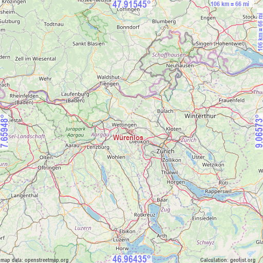
Würenlos GPS coordinates[2]
47° 26' 31.38" North, 8° 21' 45.396" East
| Map corner | latitude | longitude |
|---|---|---|
| Upper-left | 47.91545°, | 7.65948° |
| Center: | 47.44205°, | 8.36261° |
| Lower-right: | 46.96435°, | 9.06573° |
| Map W x H: | 105.8×105.8 km | = 65.7×65.7mi |
| max Lat: | 47.76737° ⇑19% North |
| Würenlos: | 47.44205° |
| min Lat: | ⇓81% South 45.83203° |
| min Long | Würenlos | max Long |
| 5.97153° | 8.36261° | 10.44624° |
| W 48.2%⇐ | ⇒51.8% E |
Elevation
Elevation of Würenlos is 407 m = 1335 ft, and this is 151.2 m = 496 ft below average elevation for this country.
| Max E: |
1845 m = 6053 ft | 86.2% |
| Avg. | 558.2 m = 1831 ft | |
| Würenlos | 407 m = 1335 ft | |
Min E: |
197 m = 646 ft | 13.8% |
See also: Switzerland elevation on elevation.city.
Geographical zone
Würenlos is located in North temperate zone (between Tropic of Cancer and the Arctic Circle). Distance of this North polar circle is 2126.1 km =1321.1 mi to North.| Distance of | km | miles | from Würenlos |
|---|---|---|---|
| North Pole | 4732 | 2940.3 | to North |
| Arctic Circle | 2126.1 | 1321.1 | to North |
| Tropic Cancer | 2669.1 | 1658.5 | to South |
| Equator | 5275.1 | 3277.8 | to South |


Nearby cities:
15 places around Würenlos: (largest is in red/bold)
• Boppelsen
4.5 km =2.8 mi,  47°
47°
• Dietikon / Fondli
4.2 km =2.6 mi,  153°
153°
• Dietikon / Vorstadt
4.6 km =2.9 mi, 145°
• Dänikon
3.3 km =2.1 mi,  81°
81°
• Dänikon / Bifang
3.5 km =2.2 mi, 80°
• Geroldswil
4.3 km =2.7 mi,  121°
121°
• Geroldswil / Bergacker
3.9 km =2.4 mi, 117°
• Geroldswil / Huebwiesen
4.1 km =2.5 mi, 121°
• Killwangen
1.4 km =0.9 mi,  218°
218°
• Neuenhof
2.8 km =1.7 mi,  287°
287°
• Oberrohrdorf
4.2 km =2.6 mi,  230°
230°
• Oetwil / Oetwil an der Limmat
2.9 km =1.8 mi, 122°
• Otelfingen
3 km =1.9 mi, 46°
• Rain
3.5 km =2.2 mi,  87°
87°
• Spreitenbach
2.2 km =1.4 mi,  169°
169°
Sources, notices
• [Note1] Compared only with cities in Switzerland existing in our database
• [Src1] Map data: © OpenStreetMap contributors (CC-BY-SA)
• [Src2] Other city data from geonames.org with taken over terms of usage.
• [Src3] Geographical zone / Annual Mean Temperature by Robert A. Rohde @ Wikipedia
