Oberrohrdorf geodata
Oberrohrdorf (Aargau) is a populated place; located in Switzerland in Europe/Zurich (GMT+2) time zone. With population of 4,001 people, there are 441 cities with bigger population in this country. Compared to other cities in Switzerland, 77.4% of cities are located further ↓South; 52.6% of cities are located further →East and 60% of cities have lower elevation than Oberrohrdorf. Note1


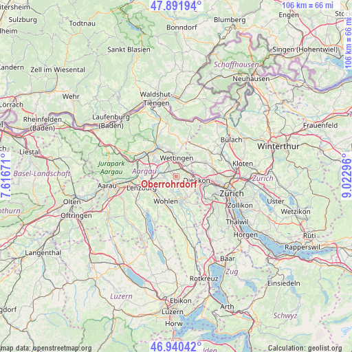
Oberrohrdorf GPS coordinates[2]
47° 25' 5.988" North, 8° 19' 11.388" East
| Map corner | latitude | longitude |
|---|---|---|
| Upper-left | 47.89194°, | 7.61671° |
| Center: | 47.41833°, | 8.31983° |
| Lower-right: | 46.94042°, | 9.02296° |
| Map W x H: | 105.8×105.8 km | = 65.7×65.7mi |
| max Lat: | 47.76737° ⇑22.6% North |
| Oberrohrdorf: | 47.41833° |
| min Lat: | ⇓77.4% South 45.83203° |
| min Long | Oberrohrdorf | max Long |
| 5.97153° | 8.31983° | 10.44624° |
| W 47.4%⇐ | ⇒52.6% E |
Elevation
Elevation of Oberrohrdorf is 519 m = 1703 ft, and this is 39.2 m = 129 ft below average elevation for this country.
| Max E: |
1845 m = 6053 ft | 40% |
| Avg. | 558.2 m = 1831 ft | |
| Oberrohrdorf | 519 m = 1703 ft | |
Min E: |
197 m = 646 ft | 60% |
See also: Switzerland elevation on elevation.city.
Geographical zone
Oberrohrdorf is located in North temperate zone (between Tropic of Cancer and the Arctic Circle). Distance of this North polar circle is 2128.8 km =1322.8 mi to North.| Distance of | km | miles | from Oberrohrdorf |
|---|---|---|---|
| North Pole | 4734.6 | 2941.9 | to North |
| Arctic Circle | 2128.8 | 1322.8 | to North |
| Tropic Cancer | 2666.5 | 1656.9 | to South |
| Equator | 5272.4 | 3276.1 | to South |


Nearby cities:
15 places around Oberrohrdorf: (largest is in red/bold)
• Baden
6.2 km =3.9 mi,  350°
350°
• Dietikon / Almend
5.6 km =3.5 mi,  105°
105°
• Dietikon / Fondli
5.2 km =3.2 mi,  102°
102°
• Dietikon / Oberdorf
5.9 km =3.7 mi, 109°
• Dietikon / Vorstadt
5.9 km =3.7 mi, 100°
• Hägglingen
6 km =3.7 mi,  236°
236°
• Killwangen
2.8 km =1.7 mi,  56°
56°
• Künten
3.4 km =2.1 mi,  166°
166°
• Mellingen
3.5 km =2.2 mi,  271°
271°
• Neuenhof
3.5 km =2.2 mi,  8°
8°
• Niederrohrdorf
1.3 km =0.8 mi,  298°
298°
• Oetwil / Oetwil an der Limmat
5.8 km =3.6 mi,  78°
78°
• Spreitenbach
3.7 km =2.3 mi, 82°
• Wettingen
5.8 km =3.6 mi,  357°
357°
• Würenlos
4.2 km =2.6 mi,  50°
50°
Sources, notices
• [Note1] Compared only with cities in Switzerland existing in our database
• [Src1] Map data: © OpenStreetMap contributors (CC-BY-SA)
• [Src2] Other city data from geonames.org with taken over terms of usage.
• [Src3] Geographical zone / Annual Mean Temperature by Robert A. Rohde @ Wikipedia
