Boppelsen geodata
Boppelsen (Zurich) is a populated place; located in Switzerland in Europe/Zurich (GMT+2) time zone. With population of 893 people, there are 1425 cities with bigger population in this country. Compared to other cities in Switzerland, 84.8% of cities are located further ↓South; 50% of cities are located further ←West and 61.7% of cities have lower elevation than Boppelsen. Note1


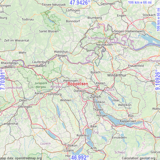
Boppelsen GPS coordinates[2]
47° 28' 10.02" North, 8° 24' 22.104" East
| Map corner | latitude | longitude |
|---|---|---|
| Upper-left | 47.9426°, | 7.70301° |
| Center: | 47.46945°, | 8.40614° |
| Lower-right: | 46.992°, | 9.10926° |
| Map W x H: | 105.7×105.7 km | = 65.7×65.7mi |
| max Lat: | 47.76737° ⇑15.2% North |
| Boppelsen: | 47.46945° |
| min Lat: | ⇓84.8% South 45.83203° |
| min Long | Boppelsen | max Long |
| 5.97153° | 8.40614° | 10.44624° |
| W 50%⇐ | ⇒50% E |
Elevation
Elevation of Boppelsen is 530 m = 1739 ft, and this is 28.2 m = 93 ft below average elevation for this country.
| Max E: |
1845 m = 6053 ft | 38.3% |
| Avg. | 558.2 m = 1831 ft | |
| Boppelsen | 530 m = 1739 ft | |
Min E: |
197 m = 646 ft | 61.7% |
See also: Switzerland elevation on elevation.city.
Geographical zone
Boppelsen is located in North temperate zone (between Tropic of Cancer and the Arctic Circle). Distance of this North polar circle is 2123.1 km =1319.2 mi to North.| Distance of | km | miles | from Boppelsen |
|---|---|---|---|
| North Pole | 4729 | 2938.5 | to North |
| Arctic Circle | 2123.1 | 1319.2 | to North |
| Tropic Cancer | 2672.2 | 1660.4 | to South |
| Equator | 5278.1 | 3279.7 | to South |


Nearby cities:
15 places around Boppelsen: (largest is in red/bold)
• Buchs / Buchs (Nord)
2.4 km =1.5 mi,  113°
113°
• Buchs / Ringstrasse
3 km =1.9 mi,  122°
122°
• Buchs / Zürcherstrasse
3 km =1.9 mi, 117°
• Dielsdorf
4.2 km =2.6 mi,  71°
71°
• Dällikon / Dällikon (Dorf)
4.1 km =2.5 mi,  143°
143°
• Dällikon / Sytenacher
4.5 km =2.8 mi, 139°
• Dänikon
2.5 km =1.6 mi,  179°
179°
• Dänikon / Bifang
2.5 km =1.6 mi, 176°
• Oberweningen
3.6 km =2.2 mi,  1°
1°
• Otelfingen
1.5 km =0.9 mi,  228°
228°
• Rain
2.9 km =1.8 mi,  174°
174°
• Schibler
3.9 km =2.4 mi,  58°
58°
• Sonnhalde
4.5 km =2.8 mi, 113°
• Steinmaur / Nieder-Steinmaur
4.1 km =2.5 mi,  50°
50°
• Würenlos
4.5 km =2.8 mi, 227°
Sources, notices
• [Note1] Compared only with cities in Switzerland existing in our database
• [Src1] Map data: © OpenStreetMap contributors (CC-BY-SA)
• [Src2] Other city data from geonames.org with taken over terms of usage.
• [Src3] Geographical zone / Annual Mean Temperature by Robert A. Rohde @ Wikipedia
