Schwarzenberg geodata
Schwarzenberg (Lucerne) is a populated place; located in Switzerland in Europe/Zurich (GMT+2) time zone. With population of 1,591 people, there are 985 cities with bigger population in this country. Compared to other cities in Switzerland, 63.6% of cities are located further ↑North; 56.3% of cities are located further →East and 89.9% of cities have lower elevation than Schwarzenberg. Note1


Schwarzenberg GPS coordinates[2]
47° 1' 1.38" North, 8° 10' 21.396" East
| Map corner | latitude | longitude |
|---|---|---|
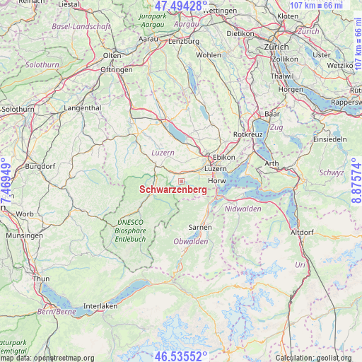
| Upper-left | 47.49428°, | 7.46949° |
| Center: | 47.01705°, | 8.17261° |
| Lower-right: | 46.53552°, | 8.87574° |
| Map W x H: | 106.6×106.6 km | = 66.2×66.2mi |
| max Lat: | 47.76737° ⇑63.6% North |
| Schwarzenberg: | 47.01705° |
| min Lat: | ⇓36.4% South 45.83203° |
| min Long | Schwarzenberg | max Long |
| 5.97153° | 8.17261° | 10.44624° |
| W 43.7%⇐ | ⇒56.3% E |
Elevation
Elevation of Schwarzenberg is 817 m = 2680 ft, and this is 258.8 m = 849 ft above average elevation for this country.
| Max E: |
1845 m = 6053 ft | 10.1% |
| Schwarzenberg | 817 m 2680 ft | |
| Avg. | 558.2 m = 1831 ft | |
Min E: |
197 m = 646 ft | 89.9% |
See also: Switzerland elevation on elevation.city.
Geographical zone
Schwarzenberg is located in North temperate zone (between Tropic of Cancer and the Arctic Circle). Distance of this North polar circle is 2173.4 km =1350.5 mi to North.| Distance of | km | miles | from Schwarzenberg |
|---|---|---|---|
| North Pole | 4779.3 | 2969.7 | to North |
| Arctic Circle | 2173.4 | 1350.5 | to North |
| Tropic Cancer | 2621.9 | 1629.2 | to South |
| Equator | 5227.8 | 3248.4 | to South |


Nearby cities:
15 places around Schwarzenberg: (largest is in red/bold)
• Alpnach
11.2 km =7 mi,  137°
137°
• Doppleschwand
8.9 km =5.5 mi,  270°
270°
• Emmen
10.2 km =6.3 mi,  48°
48°
• Entlebuch
8.6 km =5.3 mi,  253°
253°
• Hasle
10 km =6.2 mi,  244°
244°
• Hergiswil
11 km =6.8 mi,  109°
109°
• Horw
10.4 km =6.5 mi,  90°
90°
• Kriens
8.7 km =5.4 mi,  79°
79°
• Littau
7.8 km =4.8 mi,  61°
61°
• Luzern
10.8 km =6.7 mi,  69°
69°
• Malters
2.3 km =1.4 mi,  18°
18°
• Neuenkirch
9.5 km =5.9 mi,  14°
14°
• Ruswil
8.2 km =5.1 mi,  334°
334°
• Werthenstein
6.9 km =4.3 mi,  308°
308°
• Wolhusen
8.9 km =5.5 mi,  302°
302°
Sources, notices
• [Note1] Compared only with cities in Switzerland existing in our database
• [Src1] Map data: © OpenStreetMap contributors (CC-BY-SA)
• [Src2] Other city data from geonames.org with taken over terms of usage.
• [Src3] Geographical zone / Annual Mean Temperature by Robert A. Rohde @ Wikipedia
