Walkringen geodata
Walkringen (Bern) is a populated place; located in Switzerland in Europe/Zurich (GMT+2) time zone. With population of 1,817 people, there are 900 cities with bigger population in this country. Compared to other cities in Switzerland, 67% of cities are located further ↑North; 70.9% of cities are located further →East and 82.2% of cities have lower elevation than Walkringen. Note1


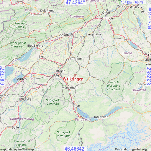
Walkringen GPS coordinates[2]
46° 56' 54.816" North, 7° 37' 13.44" East
| Map corner | latitude | longitude |
|---|---|---|
| Upper-left | 47.4264°, | 6.91727° |
| Center: | 46.94856°, | 7.6204° |
| Lower-right: | 46.46642°, | 8.32352° |
| Map W x H: | 106.7×106.7 km | = 66.3×66.3mi |
| max Lat: | 47.76737° ⇑67% North |
| Walkringen: | 46.94856° |
| min Lat: | ⇓33% South 45.83203° |
| min Long | Walkringen | max Long |
| 5.97153° | 7.6204° | 10.44624° |
| W 29.1%⇐ | ⇒70.9% E |
Elevation
Elevation of Walkringen is 693 m = 2274 ft, and this is 134.8 m = 442 ft above average elevation for this country.
| Max E: |
1845 m = 6053 ft | 17.8% |
| Walkringen | 693 m 2274 ft | |
| Avg. | 558.2 m = 1831 ft | |
Min E: |
197 m = 646 ft | 82.2% |
See also: Switzerland elevation on elevation.city.
Geographical zone
Walkringen is located in North temperate zone (between Tropic of Cancer and the Arctic Circle). Distance of this North polar circle is 2181 km =1355.2 mi to North.| Distance of | km | miles | from Walkringen |
|---|---|---|---|
| North Pole | 4786.9 | 2974.4 | to North |
| Arctic Circle | 2181 | 1355.2 | to North |
| Tropic Cancer | 2614.3 | 1624.5 | to South |
| Equator | 5220.2 | 3243.7 | to South |


Nearby cities:
15 places around Walkringen: (largest is in red/bold)
• Arni
3.7 km =2.3 mi,  113°
113°
• Biglen
2.5 km =1.6 mi,  171°
171°
• Bowil
8.5 km =5.3 mi,  136°
136°
• Konolfingen
7.7 km =4.8 mi,  180°
180°
• Krauchthal
7.9 km =4.9 mi,  328°
328°
• Landiswil
4.6 km =2.9 mi,  76°
76°
• Lützelflüh
8.5 km =5.3 mi,  39°
39°
• Oberhünigen
8.1 km =5 mi,  159°
159°
• Rubigen
8 km =5 mi,  226°
226°
• Rüderswil
8.6 km =5.3 mi,  63°
63°
• Signau
8.5 km =5.3 mi, 112°
• Stettlen
7.3 km =4.5 mi,  278°
278°
• Vechigen
4.5 km =2.8 mi,  266°
266°
• Worb
4.8 km =3 mi,  244°
244°
• Zäziwil
6.1 km =3.8 mi,  148°
148°
Sources, notices
• [Note1] Compared only with cities in Switzerland existing in our database
• [Src1] Map data: © OpenStreetMap contributors (CC-BY-SA)
• [Src2] Other city data from geonames.org with taken over terms of usage.
• [Src3] Geographical zone / Annual Mean Temperature by Robert A. Rohde @ Wikipedia
