Rüderswil geodata
Rüderswil (Bern) is a populated place; located in Switzerland in Europe/Zurich (GMT+2) time zone. With population of 2,329 people, there are 730 cities with bigger population in this country. Compared to other cities in Switzerland, 65.1% of cities are located further ↑North; 67.8% of cities are located further →East and 79.6% of cities have lower elevation than Rüderswil. Note1


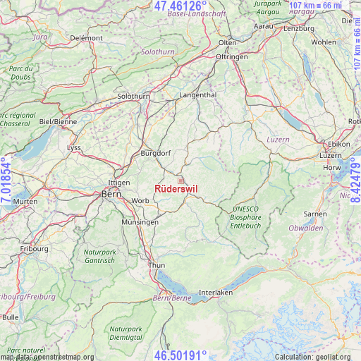
Rüderswil GPS coordinates[2]
46° 59' 1.464" North, 7° 43' 18.012" East
| Map corner | latitude | longitude |
|---|---|---|
| Upper-left | 47.46126°, | 7.01854° |
| Center: | 46.98374°, | 7.72167° |
| Lower-right: | 46.50191°, | 8.42479° |
| Map W x H: | 106.7×106.7 km | = 66.3×66.3mi |
| max Lat: | 47.76737° ⇑65.1% North |
| Rüderswil: | 46.98374° |
| min Lat: | ⇓34.9% South 45.83203° |
| min Long | Rüderswil | max Long |
| 5.97153° | 7.72167° | 10.44624° |
| W 32.2%⇐ | ⇒67.8% E |
Elevation
Elevation of Rüderswil is 656 m = 2152 ft, and this is 97.8 m = 321 ft above average elevation for this country.
| Max E: |
1845 m = 6053 ft | 20.4% |
| Rüderswil | 656 m 2152 ft | |
| Avg. | 558.2 m = 1831 ft | |
Min E: |
197 m = 646 ft | 79.6% |
See also: Switzerland elevation on elevation.city.
Geographical zone
Rüderswil is located in North temperate zone (between Tropic of Cancer and the Arctic Circle). Distance of this North polar circle is 2177.1 km =1352.8 mi to North.| Distance of | km | miles | from Rüderswil |
|---|---|---|---|
| North Pole | 4783 | 2972 | to North |
| Arctic Circle | 2177.1 | 1352.8 | to North |
| Tropic Cancer | 2618.2 | 1626.9 | to South |
| Equator | 5224.1 | 3246.1 | to South |


Nearby cities:
15 places around Rüderswil: (largest is in red/bold)
• Arni
6.9 km =4.3 mi,  218°
218°
• Biglen
9.7 km =6 mi,  228°
228°
• Bowil
10.2 km =6.3 mi,  190°
190°
• Heimiswil
10.2 km =6.3 mi,  335°
335°
• Landiswil
4.3 km =2.7 mi, 228°
• Langnau
7 km =4.3 mi,  134°
134°
• Lauperswil
2.5 km =1.6 mi,  142°
142°
• Lützelflüh
3.5 km =2.2 mi,  319°
319°
• Oberburg
9.3 km =5.8 mi,  309°
309°
• Rüegsau
5.8 km =3.6 mi, 321°
• Signau
7.2 km =4.5 mi,  178°
178°
• Sumiswald
5.2 km =3.2 mi,  20°
20°
• Trachselwald
3.9 km =2.4 mi, 16°
• Walkringen
8.6 km =5.3 mi,  243°
243°
• Zäziwil
10.2 km =6.3 mi,  206°
206°
Sources, notices
• [Note1] Compared only with cities in Switzerland existing in our database
• [Src1] Map data: © OpenStreetMap contributors (CC-BY-SA)
• [Src2] Other city data from geonames.org with taken over terms of usage.
• [Src3] Geographical zone / Annual Mean Temperature by Robert A. Rohde @ Wikipedia
