Bowil geodata
Bowil (Bern) is a populated place; located in Switzerland in Europe/Zurich (GMT+2) time zone. With population of 1,414 people, there are 1074 cities with bigger population in this country. Compared to other cities in Switzerland, 70% of cities are located further ↑North; 68.3% of cities are located further →East and 84.5% of cities have lower elevation than Bowil. Note1


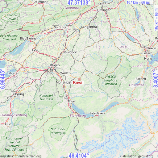
Bowil GPS coordinates[2]
46° 53' 34.944" North, 7° 41' 51.252" East
| Map corner | latitude | longitude |
|---|---|---|
| Upper-left | 47.37138°, | 6.99445° |
| Center: | 46.89304°, | 7.69757° |
| Lower-right: | 46.4104°, | 8.4007° |
| Map W x H: | 106.9×106.8 km | = 66.4×66.4mi |
| max Lat: | 47.76737° ⇑70% North |
| Bowil: | 46.89304° |
| min Lat: | ⇓30% South 45.83203° |
| min Long | Bowil | max Long |
| 5.97153° | 7.69757° | 10.44624° |
| W 31.7%⇐ | ⇒68.3% E |
Elevation
Elevation of Bowil is 730 m = 2395 ft, and this is 171.8 m = 564 ft above average elevation for this country.
| Max E: |
1845 m = 6053 ft | 15.5% |
| Bowil | 730 m 2395 ft | |
| Avg. | 558.2 m = 1831 ft | |
Min E: |
197 m = 646 ft | 84.5% |
See also: Switzerland elevation on elevation.city.
Geographical zone
Bowil is located in North temperate zone (between Tropic of Cancer and the Arctic Circle). Distance of this North polar circle is 2187.2 km =1359.1 mi to North.| Distance of | km | miles | from Bowil |
|---|---|---|---|
| North Pole | 4793 | 2978.2 | to North |
| Arctic Circle | 2187.2 | 1359.1 | to North |
| Tropic Cancer | 2608.1 | 1620.6 | to South |
| Equator | 5214 | 3239.8 | to South |


Nearby cities:
15 places around Bowil: (largest is in red/bold)
• Arni
5.3 km =3.3 mi,  331°
331°
• Biglen
6.6 km =4.1 mi,  303°
303°
• Buchholterberg
9 km =5.6 mi,  191°
191°
• Eggiwil
7.7 km =4.8 mi,  104°
104°
• Konolfingen
6.1 km =3.8 mi,  255°
255°
• Landiswil
7.4 km =4.6 mi,  349°
349°
• Langnau
8.5 km =5.3 mi,  52°
52°
• Lauperswil
8.8 km =5.5 mi,  22°
22°
• Linden
5.3 km =3.3 mi,  195°
195°
• Oberdiessbach
8.4 km =5.2 mi,  226°
226°
• Oberhünigen
3.4 km =2.1 mi,  245°
245°
• Signau
3.6 km =2.2 mi,  34°
34°
• Tägertschi
8.8 km =5.5 mi, 257°
• Walkringen
8.5 km =5.3 mi,  316°
316°
• Zäziwil
2.9 km =1.8 mi,  290°
290°
Sources, notices
• [Note1] Compared only with cities in Switzerland existing in our database
• [Src1] Map data: © OpenStreetMap contributors (CC-BY-SA)
• [Src2] Other city data from geonames.org with taken over terms of usage.
• [Src3] Geographical zone / Annual Mean Temperature by Robert A. Rohde @ Wikipedia
