Les Breuleux geodata
Les Breuleux (Jura) is a populated place; located in Switzerland in Europe/Zurich (GMT+2) time zone. With population of 1,277 people, there are 1149 cities with bigger population in this country. Compared to other cities in Switzerland, 51.6% of cities are located further ↑North; 87.6% of cities are located further →East and 95.4% of cities have lower elevation than Les Breuleux. Note1
Administrative division(s):
- Level 1: Jura
- Level 2: Franches-Montagnes District
- Level 3: Les Breuleux


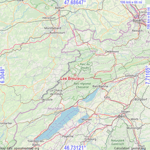
Les Breuleux GPS coordinates[2]
47° 12' 39.564" North, 7° 0' 28.512" East
| Map corner | latitude | longitude |
|---|---|---|
| Upper-left | 47.68647°, | 6.3048° |
| Center: | 47.21099°, | 7.00792° |
| Lower-right: | 46.73121°, | 7.71105° |
| Map W x H: | 106.2×106.2 km | = 66×66mi |
| max Lat: | 47.76737° ⇑51.6% North |
| Les Breuleux: | 47.21099° |
| min Lat: | ⇓48.4% South 45.83203° |
| min Long | Les Breuleux | max Long |
| 5.97153° | 7.00792° | 10.44624° |
| W 12.4%⇐ | ⇒87.6% E |
Elevation
Elevation of Les Breuleux is 1018 m = 3340 ft, and this is 459.8 m = 1509 ft above average elevation for this country.
| Max E: |
1845 m = 6053 ft | 4.6% |
| Les Breuleux | 1018 m 3340 ft | |
| Avg. | 558.2 m = 1831 ft | |
Min E: |
197 m = 646 ft | 95.4% |
See also: Switzerland elevation on elevation.city.
Geographical zone
Les Breuleux is located in North temperate zone (between Tropic of Cancer and the Arctic Circle). Distance of this North polar circle is 2151.8 km =1337.1 mi to North.| Distance of | km | miles | from Les Breuleux |
|---|---|---|---|
| North Pole | 4757.7 | 2956.3 | to North |
| Arctic Circle | 2151.8 | 1337.1 | to North |
| Tropic Cancer | 2643.5 | 1642.6 | to South |
| Equator | 5249.4 | 3261.8 | to South |


Nearby cities:
15 places around Les Breuleux: (largest is in red/bold)
• Corgémont
10.5 km =6.5 mi,  99°
99°
• Courtelary
6.1 km =3.8 mi,  126°
126°
• Dombresson
15.9 km =9.9 mi,  193°
193°
• Lajoux
12.3 km =7.6 mi,  52°
52°
• Lamboing
14.2 km =8.8 mi,  137°
137°
• Le Noirmont
4.1 km =2.5 mi,  291°
291°
• Les Bois
8.6 km =5.3 mi,  244°
244°
• Lignières
14.9 km =9.3 mi,  162°
162°
• Nods
12 km =7.5 mi,  152°
152°
• Saicourt
15.4 km =9.6 mi,  76°
76°
• Saignelégier
5.1 km =3.2 mi,  350°
350°
• Saint-Imier
6.5 km =4 mi, 187°
• Tavannes
14.4 km =8.9 mi,  85°
85°
• Tramelan
7.3 km =4.5 mi, 79°
• Villeret
5.9 km =3.7 mi,  171°
171°
Sources, notices
• [Note1] Compared only with cities in Switzerland existing in our database
• [Src1] Map data: © OpenStreetMap contributors (CC-BY-SA)
• [Src2] Other city data from geonames.org with taken over terms of usage.
• [Src3] Geographical zone / Annual Mean Temperature by Robert A. Rohde @ Wikipedia
