Le Noirmont geodata
Le Noirmont (Jura) is a populated place; located in Switzerland in Europe/Zurich (GMT+2) time zone. With population of 1,617 people, there are 971 cities with bigger population in this country. Compared to other cities in Switzerland, 50.7% of cities are located further ↑North; 88.4% of cities are located further →East and 94.2% of cities have lower elevation than Le Noirmont. Note1


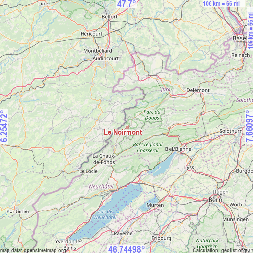
Le Noirmont GPS coordinates[2]
47° 13' 28.704" North, 6° 57' 28.224" East
| Map corner | latitude | longitude |
|---|---|---|
| Upper-left | 47.7°, | 6.25472° |
| Center: | 47.22464°, | 6.95784° |
| Lower-right: | 46.74498°, | 7.66097° |
| Map W x H: | 106.2×106.2 km | = 66×66mi |
| max Lat: | 47.76737° ⇑50.7% North |
| Le Noirmont: | 47.22464° |
| min Lat: | ⇓49.3% South 45.83203° |
| min Long | Le Noirmont | max Long |
| 5.97153° | 6.95784° | 10.44624° |
| W 11.6%⇐ | ⇒88.4% E |
Elevation
Elevation of Le Noirmont is 973 m = 3192 ft, and this is 414.8 m = 1361 ft above average elevation for this country.
| Max E: |
1845 m = 6053 ft | 5.8% |
| Le Noirmont | 973 m 3192 ft | |
| Avg. | 558.2 m = 1831 ft | |
Min E: |
197 m = 646 ft | 94.2% |
See also: Switzerland elevation on elevation.city.
Geographical zone
Le Noirmont is located in North temperate zone (between Tropic of Cancer and the Arctic Circle). Distance of this North polar circle is 2150.3 km =1336.1 mi to North.| Distance of | km | miles | from Le Noirmont |
|---|---|---|---|
| North Pole | 4756.2 | 2955.4 | to North |
| Arctic Circle | 2150.3 | 1336.1 | to North |
| Tropic Cancer | 2645 | 1643.5 | to South |
| Equator | 5250.9 | 3262.8 | to South |


Nearby cities:
15 places around Le Noirmont: (largest is in red/bold)
• Chézard-Saint-Martin
17.7 km =11 mi,  186°
186°
• Corgémont
14.5 km =9 mi,  103°
103°
• Courtelary
10.1 km =6.3 mi,  120°
120°
• Dombresson
17 km =10.6 mi,  179°
179°
• La Chaux-de-Fonds
17.1 km =10.6 mi,  215°
215°
• Lajoux
14.8 km =9.2 mi,  65°
65°
• Lamboing
18 km =11.2 mi,  131°
131°
• Les Bois
6.6 km =4.1 mi, 217°
• Les Breuleux
4.1 km =2.5 mi,  111°
111°
• Lignières
17.7 km =11 mi,  152°
152°
• Nods
15.3 km =9.5 mi,  142°
142°
• Saignelégier
4.6 km =2.9 mi,  39°
39°
• Saint-Imier
8.5 km =5.3 mi,  159°
159°
• Tramelan
11 km =6.8 mi,  90°
90°
• Villeret
8.7 km =5.4 mi, 147°
Sources, notices
• [Note1] Compared only with cities in Switzerland existing in our database
• [Src1] Map data: © OpenStreetMap contributors (CC-BY-SA)
• [Src2] Other city data from geonames.org with taken over terms of usage.
• [Src3] Geographical zone / Annual Mean Temperature by Robert A. Rohde @ Wikipedia
