Unterkulm geodata
Unterkulm (Aargau) is a seat of a second-order administrative division; located in Switzerland in Europe/Zurich (GMT+2) time zone. With population of 3,099 people, there are 570 cities with bigger population in this country. Compared to other cities in Switzerland, 59.4% of cities are located further ↓South; 57.5% of cities are located further →East and 56.3% of cities have higher elevation than Unterkulm. Note1


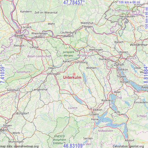
Unterkulm GPS coordinates[2]
47° 18' 35.928" North, 8° 6' 49.356" East
| Map corner | latitude | longitude |
|---|---|---|
| Upper-left | 47.78457°, | 7.41059° |
| Center: | 47.30998°, | 8.11371° |
| Lower-right: | 46.83109°, | 8.81684° |
| Map W x H: | 106×106 km | = 65.9×65.9mi |
| max Lat: | 47.76737° ⇑40.6% North |
| Unterkulm: | 47.30998° |
| min Lat: | ⇓59.4% South 45.83203° |
| min Long | Unterkulm | max Long |
| 5.97153° | 8.11371° | 10.44624° |
| W 42.5%⇐ | ⇒57.5% E |
Elevation
Elevation of Unterkulm is 464 m = 1522 ft, and this is 94.2 m = 309 ft below average elevation for this country.
| Max E: |
1845 m = 6053 ft | 56.3% |
| Avg. | 558.2 m = 1831 ft | |
| Unterkulm | 464 m = 1522 ft | |
Min E: |
197 m = 646 ft | 43.7% |
See also: Switzerland elevation on elevation.city.
Geographical zone
Unterkulm is located in North temperate zone (between Tropic of Cancer and the Arctic Circle). Distance of this North polar circle is 2140.8 km =1330.2 mi to North.| Distance of | km | miles | from Unterkulm |
|---|---|---|---|
| North Pole | 4746.7 | 2949.5 | to North |
| Arctic Circle | 2140.8 | 1330.2 | to North |
| Tropic Cancer | 2654.5 | 1649.4 | to South |
| Equator | 5260.4 | 3268.7 | to South |


Nearby cities:
15 places around Unterkulm: (largest is in red/bold)
• Birrwil
6.7 km =4.2 mi,  108°
108°
• Boniswil
5.8 km =3.6 mi,  81°
81°
• Dürrenäsch
3.6 km =2.2 mi,  70°
70°
• Gontenschwil
4.8 km =3 mi,  151°
151°
• Gränichen
5.5 km =3.4 mi,  351°
351°
• Kirchleerau
5.2 km =3.2 mi,  223°
223°
• Leutwil
4.5 km =2.8 mi,  90°
90°
• Muhen
5.3 km =3.3 mi,  303°
303°
• Oberkulm
1.4 km =0.9 mi, 151°
• Schlossrued
2.8 km =1.7 mi, 223°
• Schöftland
4.7 km =2.9 mi,  264°
264°
• Seon
5.6 km =3.5 mi,  39°
39°
• Staffelbach
6.1 km =3.8 mi,  241°
241°
• Teufenthal
2.1 km =1.3 mi,  8°
8°
• Uerkheim
6.9 km =4.3 mi, 264°
Sources, notices
• [Note1] Compared only with cities in Switzerland existing in our database
• [Src1] Map data: © OpenStreetMap contributors (CC-BY-SA)
• [Src2] Other city data from geonames.org with taken over terms of usage.
• [Src3] Geographical zone / Annual Mean Temperature by Robert A. Rohde @ Wikipedia
