Schöftland geodata
Schöftland (Aargau) is a populated place; located in Switzerland in Europe/Zurich (GMT+2) time zone. With population of 3,310 people, there are 526 cities with bigger population in this country. Compared to other cities in Switzerland, 58.8% of cities are located further ↓South; 59% of cities are located further →East and 57% of cities have higher elevation than Schöftland. Note1


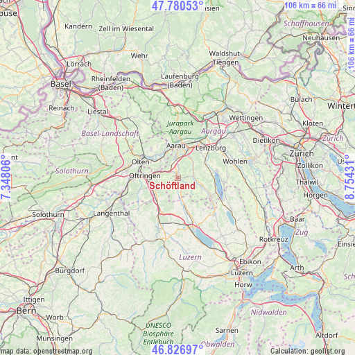
Schöftland GPS coordinates[2]
47° 18' 21.24" North, 8° 3' 4.284" East
| Map corner | latitude | longitude |
|---|---|---|
| Upper-left | 47.78053°, | 7.34806° |
| Center: | 47.3059°, | 8.05119° |
| Lower-right: | 46.82697°, | 8.75431° |
| Map W x H: | 106×106 km | = 65.9×65.9mi |
| max Lat: | 47.76737° ⇑41.2% North |
| Schöftland: | 47.3059° |
| min Lat: | ⇓58.8% South 45.83203° |
| min Long | Schöftland | max Long |
| 5.97153° | 8.05119° | 10.44624° |
| W 41%⇐ | ⇒59% E |
Elevation
Elevation of Schöftland is 462 m = 1516 ft, and this is 96.2 m = 316 ft below average elevation for this country.
| Max E: |
1845 m = 6053 ft | 57% |
| Avg. | 558.2 m = 1831 ft | |
| Schöftland | 462 m = 1516 ft | |
Min E: |
197 m = 646 ft | 43% |
See also: Switzerland elevation on elevation.city.
Geographical zone
Schöftland is located in North temperate zone (between Tropic of Cancer and the Arctic Circle). Distance of this North polar circle is 2141.3 km =1330.5 mi to North.| Distance of | km | miles | from Schöftland |
|---|---|---|---|
| North Pole | 4747.1 | 2949.7 | to North |
| Arctic Circle | 2141.3 | 1330.5 | to North |
| Tropic Cancer | 2654 | 1649.1 | to South |
| Equator | 5259.9 | 3268.3 | to South |


Nearby cities:
15 places around Schöftland: (largest is in red/bold)
• Bottenwil
4.1 km =2.5 mi,  235°
235°
• Gränichen
7.1 km =4.4 mi,  33°
33°
• Kirchleerau
3.5 km =2.2 mi,  161°
161°
• Kölliken
3.7 km =2.3 mi,  324°
324°
• Muhen
3.3 km =2.1 mi,  5°
5°
• Oberentfelden
5.6 km =3.5 mi,  355°
355°
• Oberkulm
5.4 km =3.4 mi,  98°
98°
• Safenwil
5.5 km =3.4 mi,  288°
288°
• Schlossrued
3.2 km =2 mi,  119°
119°
• Staffelbach
2.5 km =1.6 mi,  195°
195°
• Suhr
7.6 km =4.7 mi,  16°
16°
• Teufenthal
5.6 km =3.5 mi,  62°
62°
• Uerkheim
2.1 km =1.3 mi,  262°
262°
• Unterkulm
4.7 km =2.9 mi,  84°
84°
• Winikon
7.8 km =4.8 mi,  181°
181°
Sources, notices
• [Note1] Compared only with cities in Switzerland existing in our database
• [Src1] Map data: © OpenStreetMap contributors (CC-BY-SA)
• [Src2] Other city data from geonames.org with taken over terms of usage.
• [Src3] Geographical zone / Annual Mean Temperature by Robert A. Rohde @ Wikipedia
