Seon geodata
Seon (Aargau) is a populated place; located in Switzerland in Europe/Zurich (GMT+2) time zone. With population of 4,407 people, there are 395 cities with bigger population in this country. Compared to other cities in Switzerland, 64.3% of cities are located further ↓South; 56.5% of cities are located further →East and 70.8% of cities have higher elevation than Seon. Note1


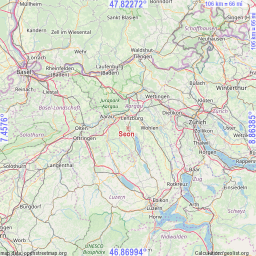
Seon GPS coordinates[2]
47° 20' 54.528" North, 8° 9' 38.592" East
| Map corner | latitude | longitude |
|---|---|---|
| Upper-left | 47.82272°, | 7.4576° |
| Center: | 47.34848°, | 8.16072° |
| Lower-right: | 46.86994°, | 8.86385° |
| Map W x H: | 105.9×105.9 km | = 65.8×65.8mi |
| max Lat: | 47.76737° ⇑35.7% North |
| Seon: | 47.34848° |
| min Lat: | ⇓64.3% South 45.83203° |
| min Long | Seon | max Long |
| 5.97153° | 8.16072° | 10.44624° |
| W 43.5%⇐ | ⇒56.5% E |
Elevation
Elevation of Seon is 438 m = 1437 ft, and this is 120.2 m = 394 ft below average elevation for this country.
| Max E: |
1845 m = 6053 ft | 70.8% |
| Avg. | 558.2 m = 1831 ft | |
| Seon | 438 m = 1437 ft | |
Min E: |
197 m = 646 ft | 29.2% |
See also: Switzerland elevation on elevation.city.
Geographical zone
Seon is located in North temperate zone (between Tropic of Cancer and the Arctic Circle). Distance of this North polar circle is 2136.5 km =1327.6 mi to North.| Distance of | km | miles | from Seon |
|---|---|---|---|
| North Pole | 4742.4 | 2946.8 | to North |
| Arctic Circle | 2136.5 | 1327.6 | to North |
| Tropic Cancer | 2658.7 | 1652 | to South |
| Equator | 5264.7 | 3271.3 | to South |


Nearby cities:
15 places around Seon: (largest is in red/bold)
• Boniswil
4.1 km =2.5 mi,  147°
147°
• Dürrenäsch
3.1 km =1.9 mi,  182°
182°
• Egliswil
1.9 km =1.2 mi,  87°
87°
• Gränichen
4.6 km =2.9 mi,  285°
285°
• Hendschiken
6 km =3.7 mi,  45°
45°
• Lenzburg
4.6 km =2.9 mi,  13°
13°
• Leutwil
4.4 km =2.7 mi,  167°
167°
• Niederlenz
5.9 km =3.7 mi, 11°
• Oberkulm
6.2 km =3.9 mi,  207°
207°
• Rupperswil
6.3 km =3.9 mi,  337°
337°
• Schafisheim
3.4 km =2.1 mi, 336°
• Seengen
4.4 km =2.7 mi,  126°
126°
• Staufen
3.8 km =2.4 mi, 7°
• Teufenthal
3.9 km =2.4 mi,  236°
236°
• Unterkulm
5.6 km =3.5 mi,  219°
219°
Sources, notices
• [Note1] Compared only with cities in Switzerland existing in our database
• [Src1] Map data: © OpenStreetMap contributors (CC-BY-SA)
• [Src2] Other city data from geonames.org with taken over terms of usage.
• [Src3] Geographical zone / Annual Mean Temperature by Robert A. Rohde @ Wikipedia
