Staffelbach geodata
Staffelbach (Aargau) is a populated place; located in Switzerland in Europe/Zurich (GMT+2) time zone. With population of 1,059 people, there are 1292 cities with bigger population in this country. Compared to other cities in Switzerland, 56.3% of cities are located further ↓South; 59.4% of cities are located further →East and 52.6% of cities have lower elevation than Staffelbach. Note1


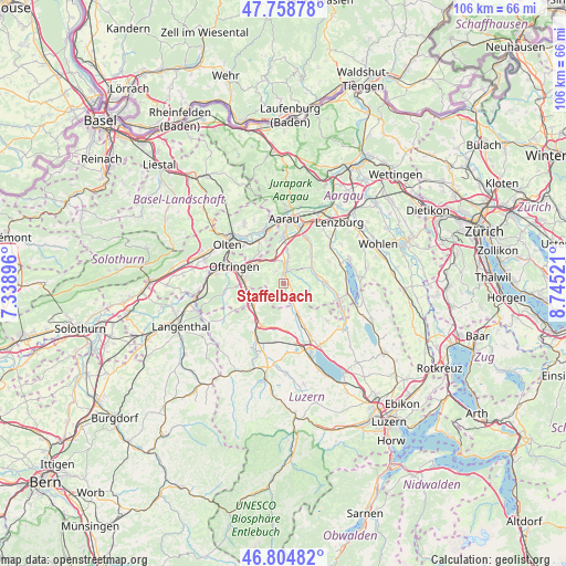
Staffelbach GPS coordinates[2]
47° 17' 2.22" North, 8° 2' 31.488" East
| Map corner | latitude | longitude |
|---|---|---|
| Upper-left | 47.75878°, | 7.33896° |
| Center: | 47.28395°, | 8.04208° |
| Lower-right: | 46.80482°, | 8.74521° |
| Map W x H: | 106.1×106.1 km | = 65.9×65.9mi |
| max Lat: | 47.76737° ⇑43.7% North |
| Staffelbach: | 47.28395° |
| min Lat: | ⇓56.3% South 45.83203° |
| min Long | Staffelbach | max Long |
| 5.97153° | 8.04208° | 10.44624° |
| W 40.6%⇐ | ⇒59.4% E |
Elevation
Elevation of Staffelbach is 486 m = 1594 ft, and this is 72.2 m = 237 ft below average elevation for this country.
| Max E: |
1845 m = 6053 ft | 47.4% |
| Avg. | 558.2 m = 1831 ft | |
| Staffelbach | 486 m = 1594 ft | |
Min E: |
197 m = 646 ft | 52.6% |
See also: Switzerland elevation on elevation.city.
Geographical zone
Staffelbach is located in North temperate zone (between Tropic of Cancer and the Arctic Circle). Distance of this North polar circle is 2143.7 km =1332 mi to North.| Distance of | km | miles | from Staffelbach |
|---|---|---|---|
| North Pole | 4749.6 | 2951.3 | to North |
| Arctic Circle | 2143.7 | 1332 | to North |
| Tropic Cancer | 2651.6 | 1647.6 | to South |
| Equator | 5257.5 | 3266.9 | to South |


Nearby cities:
15 places around Staffelbach: (largest is in red/bold)
• Bottenwil
2.7 km =1.7 mi,  272°
272°
• Kirchleerau
2 km =1.2 mi,  116°
116°
• Kölliken
5.7 km =3.5 mi,  344°
344°
• Muhen
5.8 km =3.6 mi,  9°
9°
• Oberkulm
6.3 km =3.9 mi,  74°
74°
• Reiden
6.7 km =4.2 mi,  232°
232°
• Safenwil
6.1 km =3.8 mi,  313°
313°
• Schlossrued
3.6 km =2.2 mi,  76°
76°
• Schöftland
2.5 km =1.6 mi,  15°
15°
• Triengen
6 km =3.7 mi,  154°
154°
• Uerkheim
2.6 km =1.6 mi,  326°
326°
• Unterkulm
6.1 km =3.8 mi,  61°
61°
• Wikon
6 km =3.7 mi,  247°
247°
• Winikon
5.4 km =3.4 mi,  174°
174°
• Zofingen
7.3 km =4.5 mi, 273°
Sources, notices
• [Note1] Compared only with cities in Switzerland existing in our database
• [Src1] Map data: © OpenStreetMap contributors (CC-BY-SA)
• [Src2] Other city data from geonames.org with taken over terms of usage.
• [Src3] Geographical zone / Annual Mean Temperature by Robert A. Rohde @ Wikipedia
