Weisslingen geodata
Weisslingen (Zurich) is a populated place; located in Switzerland in Europe/Zurich (GMT+2) time zone. With population of 1,975 people, there are 846 cities with bigger population in this country. Compared to other cities in Switzerland, 79.4% of cities are located further ↓South; 79.3% of cities are located further ←West and 73.1% of cities have lower elevation than Weisslingen. Note1


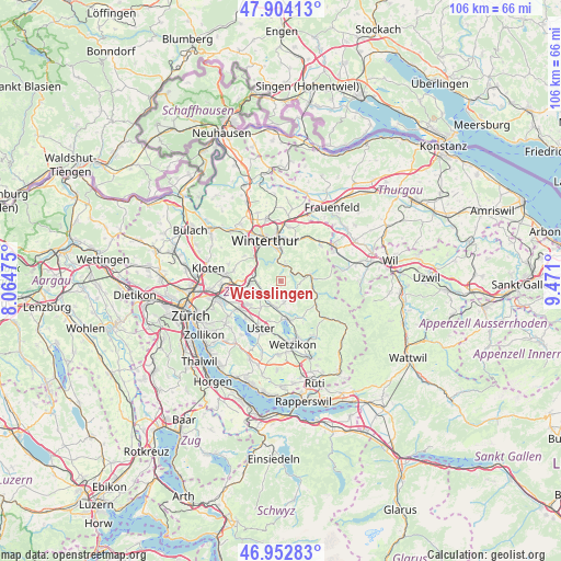
Weisslingen GPS coordinates[2]
47° 25' 50.268" North, 8° 46' 4.332" East
| Map corner | latitude | longitude |
|---|---|---|
| Upper-left | 47.90413°, | 8.06475° |
| Center: | 47.43063°, | 8.76787° |
| Lower-right: | 46.95283°, | 9.471° |
| Map W x H: | 105.8×105.8 km | = 65.7×65.7mi |
| max Lat: | 47.76737° ⇑20.6% North |
| Weisslingen: | 47.43063° |
| min Lat: | ⇓79.4% South 45.83203° |
| min Long | Weisslingen | max Long |
| 5.97153° | 8.76787° | 10.44624° |
| W 79.3%⇐ | ⇒20.7% E |
Elevation
Elevation of Weisslingen is 599 m = 1965 ft, and this is 40.8 m = 134 ft above average elevation for this country.
| Max E: |
1845 m = 6053 ft | 26.9% |
| Weisslingen | 599 m 1965 ft | |
| Avg. | 558.2 m = 1831 ft | |
Min E: |
197 m = 646 ft | 73.1% |
See also: Switzerland elevation on elevation.city.
Geographical zone
Weisslingen is located in North temperate zone (between Tropic of Cancer and the Arctic Circle). Distance of this North polar circle is 2127.4 km =1321.9 mi to North.| Distance of | km | miles | from Weisslingen |
|---|---|---|---|
| North Pole | 4733.3 | 2941.1 | to North |
| Arctic Circle | 2127.4 | 1321.9 | to North |
| Tropic Cancer | 2667.9 | 1657.8 | to South |
| Equator | 5273.8 | 3277 | to South |


Nearby cities:
15 places around Weisslingen: (largest is in red/bold)
• Effretikon / Rappenhalde-Bannhalde
5.4 km =3.4 mi,  262°
262°
• Effretikon / Watt
5.2 km =3.2 mi,  266°
266°
• Fehraltorf
4.9 km =3 mi,  194°
194°
• Grafstal
5.3 km =3.3 mi,  285°
285°
• Illnau
4.1 km =2.5 mi,  238°
238°
• Illnau / Ober-Illnau
4.3 km =2.7 mi,  245°
245°
• Illnau / Unter-Illnau
4 km =2.5 mi,  231°
231°
• Kollbrunn
3.2 km =2 mi,  20°
20°
• Kollbrunn / Kollbrunn (Dorfkern)
3 km =1.9 mi,  8°
8°
• Rikon / Rikon (Dorfkern)
2.8 km =1.7 mi,  53°
53°
• Russikon
3.8 km =2.4 mi,  171°
171°
• Rämismühle
4.2 km =2.6 mi,  76°
76°
• Seen (Kreis 3)
5.1 km =3.2 mi,  1°
1°
• Seen (Kreis 3) / Iberg
3.9 km =2.4 mi, 10°
• Seen (Kreis 3) / Sennhof
4.2 km =2.6 mi,  349°
349°
Sources, notices
• [Note1] Compared only with cities in Switzerland existing in our database
• [Src1] Map data: © OpenStreetMap contributors (CC-BY-SA)
• [Src2] Other city data from geonames.org with taken over terms of usage.
• [Src3] Geographical zone / Annual Mean Temperature by Robert A. Rohde @ Wikipedia
