Triengen geodata
Triengen (Lucerne) is a populated place; located in Switzerland in Europe/Zurich (GMT+2) time zone. With population of 4,193 people, there are 413 cities with bigger population in this country. Compared to other cities in Switzerland, 50.2% of cities are located further ↓South; 58.4% of cities are located further →East and 76.4% of cities have lower elevation than Triengen. Note1


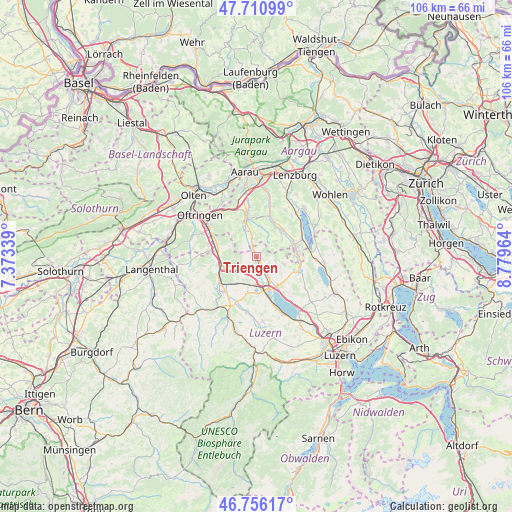
Triengen GPS coordinates[2]
47° 14' 8.628" North, 8° 4' 35.472" East
| Map corner | latitude | longitude |
|---|---|---|
| Upper-left | 47.71099°, | 7.37339° |
| Center: | 47.23573°, | 8.07652° |
| Lower-right: | 46.75617°, | 8.77964° |
| Map W x H: | 106.2×106.2 km | = 66×66mi |
| max Lat: | 47.76737° ⇑49.8% North |
| Triengen: | 47.23573° |
| min Lat: | ⇓50.2% South 45.83203° |
| min Long | Triengen | max Long |
| 5.97153° | 8.07652° | 10.44624° |
| W 41.6%⇐ | ⇒58.4% E |
Elevation
Elevation of Triengen is 629 m = 2064 ft, and this is 70.8 m = 232 ft above average elevation for this country.
| Max E: |
1845 m = 6053 ft | 23.6% |
| Triengen | 629 m 2064 ft | |
| Avg. | 558.2 m = 1831 ft | |
Min E: |
197 m = 646 ft | 76.4% |
See also: Switzerland elevation on elevation.city.
Geographical zone
Triengen is located in North temperate zone (between Tropic of Cancer and the Arctic Circle). Distance of this North polar circle is 2149.1 km =1335.4 mi to North.| Distance of | km | miles | from Triengen |
|---|---|---|---|
| North Pole | 4754.9 | 2954.6 | to North |
| Arctic Circle | 2149.1 | 1335.4 | to North |
| Tropic Cancer | 2646.2 | 1644.3 | to South |
| Equator | 5252.1 | 3263.5 | to South |


Nearby cities:
15 places around Triengen: (largest is in red/bold)
• Bottenwil
7.6 km =4.7 mi,  315°
315°
• Büron
3 km =1.9 mi,  153°
153°
• Dagmersellen
7.3 km =4.5 mi,  250°
250°
• Geuensee
4.6 km =2.9 mi, 150°
• Gontenschwil
6.5 km =4 mi,  51°
51°
• Kirchleerau
4.5 km =2.8 mi,  349°
349°
• Knutwil
4 km =2.5 mi,  183°
183°
• Mauensee
7.7 km =4.8 mi, 184°
• Schenkon
7.7 km =4.8 mi, 146°
• Schlossrued
6.3 km =3.9 mi,  8°
8°
• Staffelbach
6 km =3.7 mi,  334°
334°
• Sursee
7.7 km =4.8 mi,  160°
160°
• Uffikon
5.2 km =3.2 mi,  238°
238°
• Wauwil
7.1 km =4.4 mi,  216°
216°
• Winikon
2.1 km =1.3 mi,  270°
270°
Sources, notices
• [Note1] Compared only with cities in Switzerland existing in our database
• [Src1] Map data: © OpenStreetMap contributors (CC-BY-SA)
• [Src2] Other city data from geonames.org with taken over terms of usage.
• [Src3] Geographical zone / Annual Mean Temperature by Robert A. Rohde @ Wikipedia
