Trasadingen geodata
Trasadingen (Schaffhausen) is a populated place; located in Switzerland in Europe/Zurich (GMT+2) time zone. With population of 558 people, there are 1737 cities with bigger population in this country. Compared to other cities in Switzerland, 98.8% of cities are located further ↓South; 51.6% of cities are located further ←West and 85.1% of cities have higher elevation than Trasadingen. Note1
Administrative division(s):
- Level 1: Schaffhausen
- Level 2: Bezirk Unterklettgau
- Level 3: Trasadingen


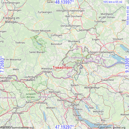
Trasadingen GPS coordinates[2]
47° 40' 7.032" North, 8° 25' 47.82" East
| Map corner | latitude | longitude |
|---|---|---|
| Upper-left | 48.13997°, | 7.72683° |
| Center: | 47.66862°, | 8.42995° |
| Lower-right: | 47.19297°, | 9.13308° |
| Map W x H: | 105.3×105.3 km | = 65.4×65.4mi |
| max Lat: | 47.76737° ⇑1.2% North |
| Trasadingen: | 47.66862° |
| min Lat: | ⇓98.8% South 45.83203° |
| min Long | Trasadingen | max Long |
| 5.97153° | 8.42995° | 10.44624° |
| W 51.6%⇐ | ⇒48.4% E |
Elevation
Elevation of Trasadingen is 410 m = 1345 ft, and this is 148.2 m = 486 ft below average elevation for this country.
| Max E: |
1845 m = 6053 ft | 85.1% |
| Avg. | 558.2 m = 1831 ft | |
| Trasadingen | 410 m = 1345 ft | |
Min E: |
197 m = 646 ft | 14.9% |
See also: Switzerland elevation on elevation.city.
Geographical zone
Trasadingen is located in North temperate zone (between Tropic of Cancer and the Arctic Circle). Distance of this North polar circle is 2100.9 km =1305.4 mi to North.| Distance of | km | miles | from Trasadingen |
|---|---|---|---|
| North Pole | 4706.8 | 2924.7 | to North |
| Arctic Circle | 2100.9 | 1305.4 | to North |
| Tropic Cancer | 2694.3 | 1674.2 | to South |
| Equator | 5300.3 | 3293.5 | to South |


Nearby cities:
15 places around Trasadingen: (largest is in red/bold)
• Beringen
11.3 km =7 mi,  73°
73°
• Eglisau
12.2 km =7.6 mi,  146°
146°
• Gächlingen
6.4 km =4 mi,  53°
53°
• Hallau
3.8 km =2.4 mi,  34°
34°
• Hüntwangen
9.3 km =5.8 mi, 150°
• Löhningen
9.9 km =6.2 mi, 68°
• Neunkirch
5.8 km =3.6 mi, 65°
• Rafz
11.1 km =6.9 mi,  130°
130°
• Schleitheim
9.7 km =6 mi,  23°
23°
• Seglingen
12.7 km =7.9 mi, 147°
• Wasterkingen
9.3 km =5.8 mi,  160°
160°
• Weiach
12.2 km =7.6 mi,  178°
178°
• Weiach / Weiach (Dorfkern)
12.5 km =7.8 mi, 177°
• Wil
9.2 km =5.7 mi,  140°
140°
• Wilchingen
2.8 km =1.7 mi,  92°
92°
Sources, notices
• [Note1] Compared only with cities in Switzerland existing in our database
• [Src1] Map data: © OpenStreetMap contributors (CC-BY-SA)
• [Src2] Other city data from geonames.org with taken over terms of usage.
• [Src3] Geographical zone / Annual Mean Temperature by Robert A. Rohde @ Wikipedia
