Wasterkingen geodata
Wasterkingen (Zurich) is a populated place; located in Switzerland in Europe/Zurich (GMT+2) time zone. With population of 521 people, there are 1778 cities with bigger population in this country. Compared to other cities in Switzerland, 96.7% of cities are located further ↓South; 55.3% of cities are located further ←West and 92% of cities have higher elevation than Wasterkingen. Note1


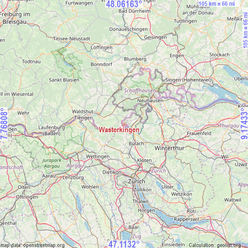
Wasterkingen GPS coordinates[2]
47° 35' 22.416" North, 8° 28' 16.356" East
| Map corner | latitude | longitude |
|---|---|---|
| Upper-left | 48.06163°, | 7.76808° |
| Center: | 47.58956°, | 8.47121° |
| Lower-right: | 47.1132°, | 9.17433° |
| Map W x H: | 105.5×105.5 km | = 65.6×65.6mi |
| max Lat: | 47.76737° ⇑3.3% North |
| Wasterkingen: | 47.58956° |
| min Lat: | ⇓96.7% South 45.83203° |
| min Long | Wasterkingen | max Long |
| 5.97153° | 8.47121° | 10.44624° |
| W 55.3%⇐ | ⇒44.7% E |
Elevation
Elevation of Wasterkingen is 386 m = 1266 ft, and this is 172.2 m = 565 ft below average elevation for this country.
| Max E: |
1845 m = 6053 ft | 92% |
| Avg. | 558.2 m = 1831 ft | |
| Wasterkingen | 386 m = 1266 ft | |
Min E: |
197 m = 646 ft | 8% |
See also: Switzerland elevation on elevation.city.
Geographical zone
Wasterkingen is located in North temperate zone (between Tropic of Cancer and the Arctic Circle). Distance of this North polar circle is 2109.7 km =1310.9 mi to North.| Distance of | km | miles | from Wasterkingen |
|---|---|---|---|
| North Pole | 4715.6 | 2930.1 | to North |
| Arctic Circle | 2109.7 | 1310.9 | to North |
| Tropic Cancer | 2685.5 | 1668.7 | to South |
| Equator | 5291.5 | 3288 | to South |


Nearby cities:
15 places around Wasterkingen: (largest is in red/bold)
• Buchberg
7.1 km =4.4 mi,  105°
105°
• Eglisau
4 km =2.5 mi, 109°
• Glattfelden
4.1 km =2.5 mi,  146°
146°
• Hochfelden
8.2 km =5.1 mi,  155°
155°
• Hüntwangen
1.6 km =1 mi,  65°
65°
• Neerach
8.7 km =5.4 mi,  180°
180°
• Rafz
5.6 km =3.5 mi, 72°
• Seglingen
4.2 km =2.6 mi,  117°
117°
• Seglingen / Ober-Seglingen
4.6 km =2.9 mi, 115°
• Siglistorf
8.5 km =5.3 mi,  233°
233°
• Stadel
6.7 km =4.2 mi, 184°
• Weiach
4.4 km =2.7 mi,  219°
219°
• Weiach / Weiach (Dorfkern)
4.4 km =2.7 mi,  213°
213°
• Wil
3.2 km =2 mi,  59°
59°
• Wilchingen
8.7 km =5.4 mi,  358°
358°
Sources, notices
• [Note1] Compared only with cities in Switzerland existing in our database
• [Src1] Map data: © OpenStreetMap contributors (CC-BY-SA)
• [Src2] Other city data from geonames.org with taken over terms of usage.
• [Src3] Geographical zone / Annual Mean Temperature by Robert A. Rohde @ Wikipedia
